Public and Private Realms Make Urbanism

Measuring Life (or the Inherent Value of Mixed-Use)

Economic Development

“Housing is not simple… It is shelter, and it is also a financial asset, a retirement strategy, a tax base, and a source of local wealth, all shaped by regulations and finance systems and migration patterns and interest rates and demographics in ways that interact and resist clean summary.” – Chuck Marohn

Expanding on the elements of Housing (Live) complexity to Work, Play, Learn, Govern, Heal, Move, and Worship at the Neighborhood/Transit Center Scale (160-acres), Within each activity is a list of how they affect the private individual person, private company, and public entity. The intention is to be a useful measuring matrix of mixed-use neighborhoods outcomes in economic and social terms (environmental is later). These are the details of Leon Krier’s Civitas cartoon depicting the public/private/collective realms that build cities we live our daily, weekly, monthly, seasonal, annual lives within. 

THE INSTITUTIONS OF A DAILY LIFE x LIFE CYCLE – PRIMARY/secondary Realms

Housing (Live) – PRIVATE/public

  • Detached Housing
  • Attached Housing
    • Public Housing
    • Senior Housing
    • Homeless Facilities
    • Emergency Facilities

Shops (Work – Retail and Commerce) – PRIVATE

  • In-Home Offices/Shops
  • Attached Inline Shops
    • Specialty Centers (Lifestyle, Power, Strip Malls)
  • Detached Shops (Standalone or Inline)
    • Retail shopping
    • Dining and Entertainments
    • Specialty Stores
    • Grocery Stores
    • Professional Offices
    • Workshops
    • Storage Facilities
    • Manufacturing
    • Resorts

Play (Parks, Recreation, and Nature) – PUBLIC/Private

  • Indoor
    • Gyms, private
    • Swimming Pools
    • Race Tracks
  • Outdoor
    • Gyms, private
    • Recreation (golf courses, racing tracks), private
    • Amusement Parks (zoos), public/private
    • Plazas, Squares, Greens
    • Sports fields, golf courses
    • Equestrian facilities, private
    • Nature reserves, preserves, parks trail access
    • Water features, bays, shores, estuaries, creeks, streams, and rivers
    • Steep slopes, canyons, and unbuildable areas

Learn – PUBLIC/PRIVATE

  • K – 12, Public
  • K – 12, Private and Religious
  • Higher and Trade Education, Public (City and State) and Private
  • Day Care

Worship (Churches, Temples, Mosques) – PUBLIC/PRIVATE

  • Places of Ceremony
  • Education
  • Cemeteries

Governance – PUBLIC (Local, State, Federal)

  • Military Facilities (State and Federal)
  • Jails
  • Certificates
    • Birth, Marriage, Death, Driving, etc…
  • Emergency Services, Fire, Police, Ambulance
  • Tax Collection, Distribution
  • Local Post Offices, Libraries
  • Municipal Governance offices
  • Federal, State, City Courthouses, Jails
  • State Agencies hearing rooms and offices
  • City Hall, City Facilities
  • Community/Town Halls
  • Cemeteries

Health Care – PUBLIC/PRIVATE

  • Medical offices
  • Hospice care clinics
  • Outpatient clinics
  • Inpatient Hospitals
    • Births, Emergency, Deaths

Mobility – PUBLIC/PRIVATE

  • Streets and Transit Facilities, Public
  • Automobile and delivery services, Private
  • Freight trucks, private
  • Parking on/off-street, garage facilities, public and private
  • Port Facilities, public/private
    • Airplanes
    • Trains
    • Ships

More Details of each of these interact with the private Individual, private business, and public government.

Housing interacts with:

FOR PRIVATE INDIVIDUALS

  • shelter
  • financial asset
  • retirement strategy
  • source of local wealth
  • social connections

FOR PRIVATE BUSINESSES

  • financial asset
  • interest rates
  • finance systems

FOR PUBLIC ENTITIES

  • tax base
  • finance systems
  • migration patterns
  • demographics
  • shaped by regulations
  • revenue source

Business interacts with:

FOR PRIVATE INDIVIDUALS

  • source of income
  • financial asset
  • retirement strategy
  • source of local wealth
  • social connections

FOR PRIVATE BUSINESSES

  • financial asset
  • interest rates
  • finance systems

FOR PUBLIC ENTITIES

  • tax base
  • finance systems
  • migration patterns
  • demographics
  • shaped by regulations
  • organizational connections
  • revenue source

Recreating interacts with:

FOR PRIVATE INDIVIDUALS

  • personal respite/joy
  • personal enhancement
  • social connection
  • to play or perform

FOR PRIVATE BUSINESSES

  • employee supply/retention
  • financial investment
  • finance systems

FOR PUBLIC ENTITIES

  • revenue expense
  • finance systems
  • citizen/taxpayer supply/retention
  • demographics
  • shaped by regulations

Learning interacts with:

FOR PRIVATE INDIVIDUALS

  • personal enhancement
  • business strategy
  • financial asset
  • retirement strategy
  • social connection
  • source of future wealth
  • interest rates on loans (indebtedness)

FOR PRIVATE BUSINESSES

  • employee supply/retention
  • financial investment
  • finance systems

FOR PUBLIC ENTITIES

  • tax base
  • finance systems
  • migration patterns
  • demographics
  • shaped by regulations
  • organizational connections

Worshiping interacts with:

FOR PRIVATE INDIVIDUALS

  • personal enhancement
  • social connection
  • moral pattern

FOR PRIVATE BUSINESSES

  • financial systems
  • education

FOR PUBLIC ENTITIES

  • demographics
  • organizational connections

Governance interacts with:

FOR PRIVATE INDIVIDUALS

  • funding source
  • personal connection
  • social connection
  • moral pattern
  • education

FOR PRIVATE BUSINESSES

  • funding source
  • political connections
  • financial systems

FOR PUBLIC ENTITIES

  • expenditures/investments (subsidies)
  • finance systems (subsidies)
  • mobility/access patterns (streets)
  • health (code enforcement/parks)
  • welfare (code enforcement/parks)
  • safety (policy, fire, code enforcement)
  • policies/regulations (housing/mobility)
  • demographics
  • organizational connections

Health Care interacts with:

FOR PRIVATE INDIVIDUALS

  • health, welfare, safety
  • financial expenditure
  • safety net
  • birth, life, death (cradle to grave)

FOR PRIVATE BUSINESSES

  • employee supply/retention
  • financial investment,
  • financial / employee burden
  • finance systems

FOR PUBLIC ENTITIES

  • mobility/access patterns (streets)
  • health (code enforcement/parks)
  • welfare (code enforcement/parks)
  • safety (policy, fire, code enforcement)
  • policies/regulations (housing/mobility)

Mobility interacts with:

FOR PRIVATE INDIVIDUALS

  • accessing the region, nation
  • accessing home
  • accessing employment
  • accessing recreation/health care services
  • (we buy private autos and fuel with access to public transportation and road facilities)

FOR PRIVATE BUSINESSES

  • employee access
  • client access
  • sales access
  • distribution connection/access (planes, trains, trucks, boats)

FOR PUBLIC ENTITIES

  • mobility/access patterns (streets and transit facilities)
  • planes, trains, and shipping (commerce controlled by regional agencies, port/airport/rail agencies)
  • safety (policy, fire, code enforcement)
  • policies/regulations (housing/mobility)
  • expenditures/investments (subsidies)
  • finance systems (subsidies)
  • (we pay taxes to maintain thoroughfares for commerce and access)

When to and when not to Code…

Climate Action Plan, Economics, Urban Design

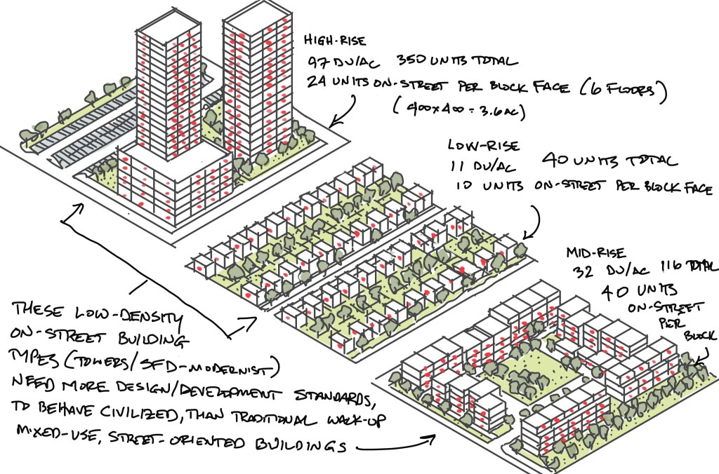
After years of writing form-based/objective design codes, I have learned the following truth… less rules are needed to build civilization w/4-floor attached, walk-ups. But, as density rises to a tower bldg type (elevator/common entry), or lowers to detached homes (sprawl), we need more design rules to civilize them.

The YIMBYs may howl at this assertion, because their priority is more and cheaper housing at all costs, but my priority is more, cheaper housing in a civilized neighborhood that is easier to build and is exceptionally more sustainable socially, environmentally, and economically than modernist construction has proven to deliver.

The mid-rise, walk-up building only needs rules to orient the front of the building towards the street, and have a shallower than a car length front setback/build-to line… otherwise, the mixed-use, walkable, transit-supported urbanism is built in. This is a pre-early 20th century, industrial building type (towers are sprawl are modern inventions) that survives today. It is more socially connected (doors on the street), economically viable (wood-frame, at-grade, shared walls/roofs), and environmentally (compact footprints, energy efficient, no concrete) sustainable than either concrete/steel towers or low-density suburban, auto-accessible sprawl. 

code diagram

Horton Plaza Needs More than Another Single-Use

Economic Development, San Diego, Urban Design, Urban Planning

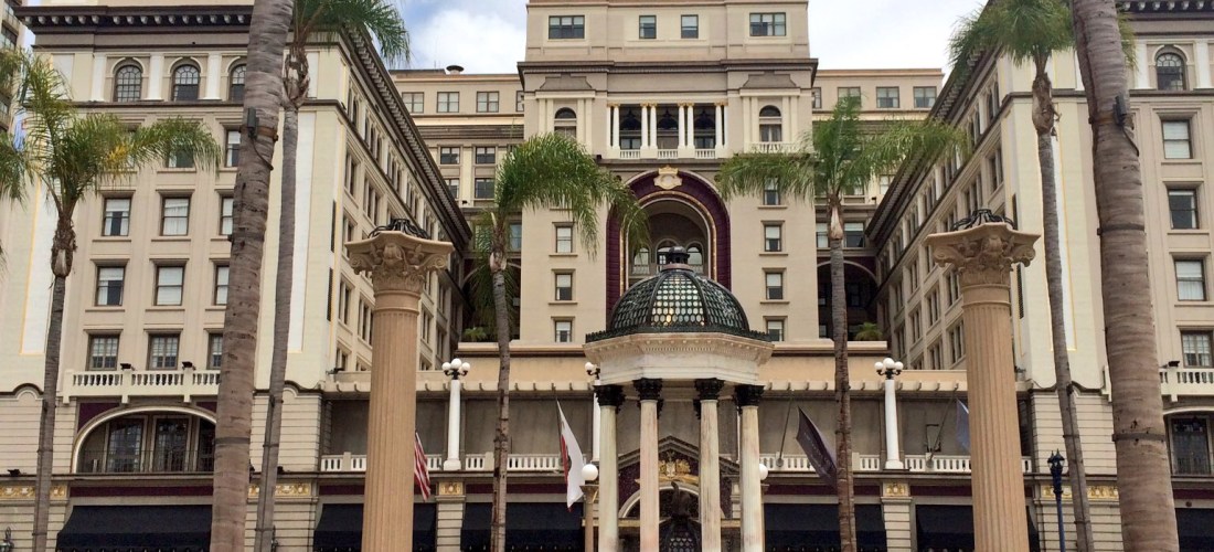
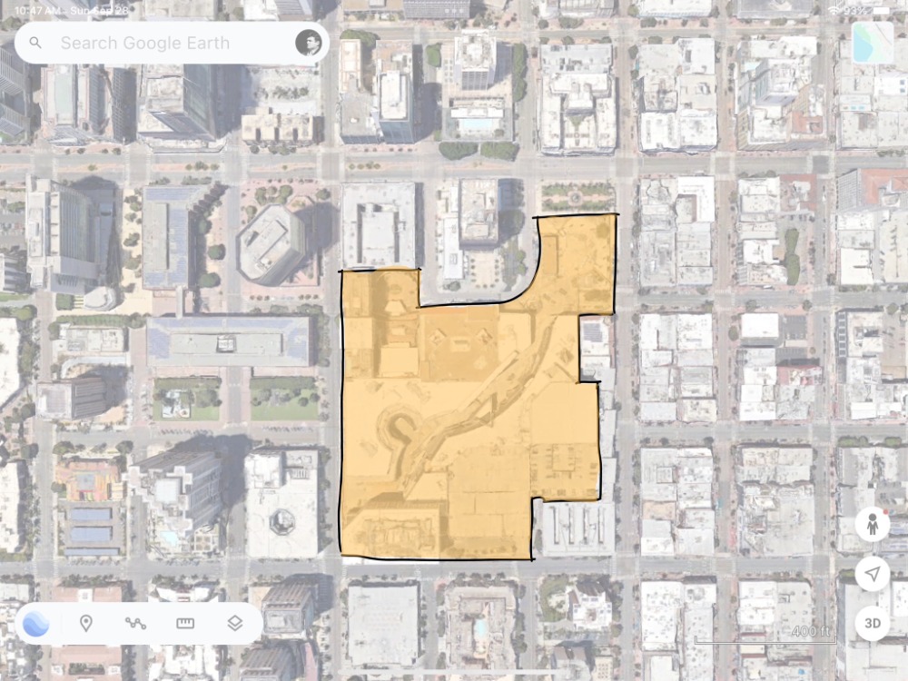
San Diego Architecture Foundation’s annual Orchids and Onions event awarded Downtown San Diego’s vacant Horton Plaza (HP) Shopping Center an Onion last fall. HP is out-of-date and unworkable, obviously. And this is true any half-vacant shopping center or 1960s office strip center throughout the nation. HP was built specifically to be an open-air, enclosed mall and it was very successful from 1980 to about 2010.

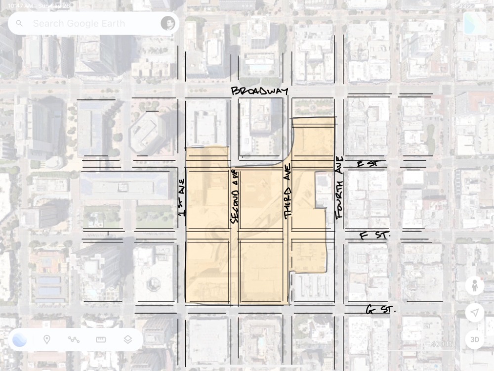
The demand for suburbia is over at this time (don’t worry, it’ll come around again in 10 years or so). While HP is not the only vacant mall trying to reinvent itself in San Diego (see slide 5 below), it is our region’s most urban/downtown one and has the same issues as any suburban retrofit project. The best mall re-invention solutions are to reestablish connections to streets/blocks currently closed and add housing. Simple, right?!? Well, it’s not as those two interventions involves the local municipality (streets/utilities/regulations), new development partners (multi-family), different lending models, and policy/regulatory updates, and building code conflicts.

It is not impossible, as Belmar in Lakeland, CO, is hands down the best retrofit and Horton will have to do the same mixed-use, connected redevelopment to be successful again.

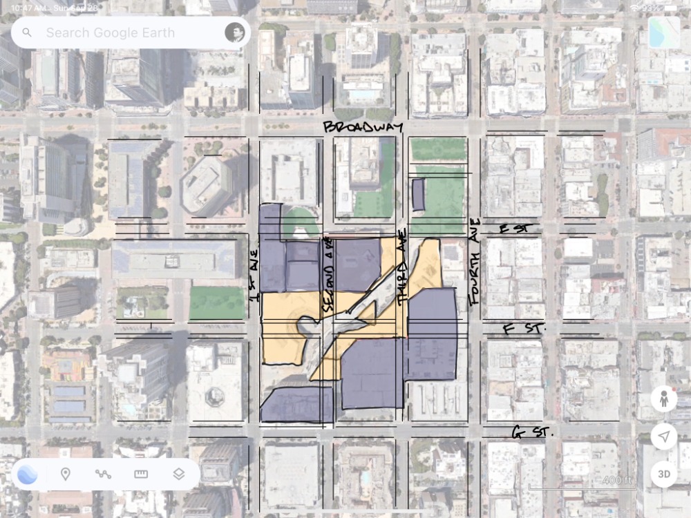
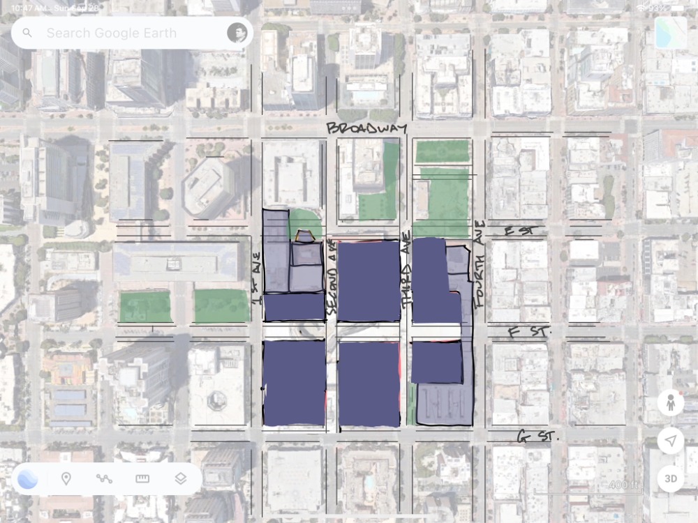
45-years ago, HP was the first return to downtown urbanism. But it was a baby-step, still suburban, and built for one private shopping center model at one point in time, and it worked for 30+ years. So, to retrofit, first, the city’s downtown code enables mixed-use. However, reconnecting closed streets are not on the city’s Capital Improvement Plan, so that process will need to be initiated by its public works program and approved by city council (Development Impact Fees pay for these improvements). Next, there are several existing, easier-to-retrofit, rational buildings to be re-used. The hotel on E and 2nd works great, as is the new office on G and 2nd, plus a couple of the parking garages. But the irrational shaped shops (slide 3 below) lining the walkway aren’t worth the effort and do the most damage to the long-term urban pattern. In my opinion, HP should demolish the irrational buildings, make full city blocks (slide 5) to reopen the public streets/blocks. This pattern will last the next hundreds of years rather than 30 – 45 years.

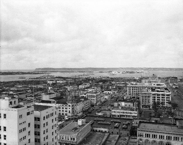
It’s not an easily adaptable building because it’s a fortified mall. And I recommend we be as ruthless with it today as they were to what was there before it (historic picture below), which was adaptable urban streets and blocks. It’s a 1980, stand-alone, single-use district within downtown. Next would be to retrofit the 1950/60s building along B Street with a completely different set of tools to transform just offices to offices/hotels/housing. And then transform seaport village, those low-rise, suburban townhomes around Pantoja Park.

The city is never built-out… especially when its full of single-use buildings and districts.

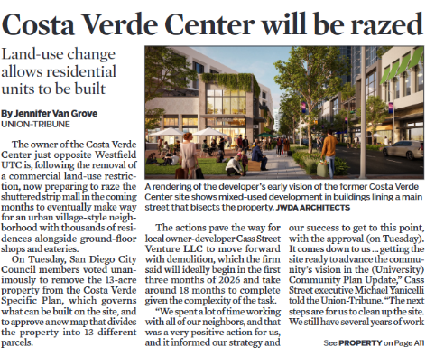
Slide 1 - Horton Plaza
Slide 2 - The streets closed to make Horton Plaza
Slide 3 - Rational (purple) and Irrational (beige) buildings
Slide 5 - How to Fix it with new rational buildings (deep purple)
Slide 6 - Contemporary Retrofit of Suburban Shopping Center

How to fix…

The Mid-21st Century Economic Development Model

Economics, Innovation Districts, Urban Design, Urban Planning

My treasured colleague and mentor, Bill Fulton, is creating our brave new post-pandemic world’s econ dev model that is a dramatic shift in how we are socializing into the mid-21st century. You can find his writings about his approach on his Substack page. He’s clearly identified and defined the patterns within the urban core/center and general urban areas and I’ve merely added the rural component to complete the ‘transect’ of econ dev place types.

Our state-by-state policy shift towards mixed-use, walkable urbanism is finally complete. Every city across the nation has general or comprehensive plan policy that allows for urban infill development. But this process has taken 30 years and the promised transit to support this new urbanism hasn’t been funded, and now we are in a new socializing era. We didn’t plan for the unintended consequences of a global pandemic… that low-density, auto-oriented, suburban homes would become mixed-use, live-work buildings.

We didn’t plan for urban downtowns to have less work and less shopping after building more housing. We didn’t plan for the cultural backlash of electing a black President and burn down our federal government and defunded our education and the transit infrastructure rather than our police and military state. Oh well… “you get the government we deserve,” said, Andres Duany once.

So here we are again in need of reforming our new urbanist, after-suburban sprawl, 20th century urbanist policies and regulations to be to meet today’s social demands. This zoning reform transitions from noxious industries co-location needs to regulating obnoxious neighbors sharing amenitized downtowns and sub-regional urban centers.

The following are a regional and citywide policy and econ dev framework for lot and block scaled zoning/regulatory reform:

Regional and Sub-Regional Urban Hotel (Transect Zones T6, T5, and T4-Neighborhood Centers)
Offers amenitized live, work, and play facilities for hyper-locals (new infill housing), locals (suburban commuters), and visitors (hotel business/pleasure). Dollars are flowing in from these types of citizen consumers.

Private Buildings and Spaces Functions
– Retail – Dining and Entertainment, and Shopping
– Daily Needs Services – Gym, spa, sundries, bodega, rentals
– Office Facilities
– Hotels (Long-Stay)
Conferencing Facilities
– Hotels (Short-Stay)
Pools, spas, gyms
– Homes – mix of uses (working and living)
– Paseos – Access between spaces and buildings
– Belvederes – Roof decks and garden terraces
– Parking Areas – Access to spaces and buildings

Public Buildings and Spaces Functions
– Conference Center
– Plazas/Squares – Destination civic space, active and contemplative
– Civic Services – Library, Post Office, City Hall, Pool

NGO Buildings and Spaces Functions
– Chamber of Commerce / Meeting Rooms and Facilities

Suburban Workshop (T4 General, and T3)
Offers live, work, and large-scale play facilities without amenities in existing suburban communities. These are static places with low-growth, and little change the appearance of the pods of housing or commercial or industrial. Auto-oriented but adding work from home and people wanting to walk around for exercise, post-pandemic.

Private Buildings and Spaces Functions
– Single-family Detached Homes
– Accessory Dwelling Units
– Yards

Public Buildings and Spaces Functions
– Ballfields

Regional Rural Substructure (T2)
A zoning conflict we’re addressing today are the regional infrastructure and utility issues bumping against either the suburbs or smaller, historic towns. Agriculture being the original regional utility/commerce.

Private Buildings and Spaces Functions
– Energy – Solar, wind, electrical (Efficiency Issues)
– Substations, powerlines (Wildfire Issues)
– Data Center Districts (The Next Big Deal to Deal with)
– Agriculture lands, Farmsteads, and Farm Worker Housing (Resort Districts)

Public Buildings and Spaces Functions
– Freeways, Highways, Corridors
– Federal and State Parks

Preserved and Pristine Nature is T1

Leonardo Divinci's City Plan, "BE COOL."

The #1 Reason for Zoning Reform: People are Obnoxious

Economic Development

Missing middle housing, and similar ideas of gentle density and incremental housing, are useful tools for cities allow for new homes to be built in existing neighborhoods. This is especially true for older or historic neighborhoods with predominantly low scale, low density, single-family detached homes. These are measured tools that transition long-standing neighborhoods from no-growth to adding more middle/medium scale housing/density/population. These new apartments/attached buildings adds a variety of people at different socioeconomic points of their lives, which smaller and larger units on the same neighborhood block tend to do. And new infill homes add tax revenues to fix old streets, sidewalks, lights, parks, and other civic infrastructure (in concept).

Fortunately the City San Diego’s planning department is starting to reform its zoning. It recently identified and adopted Transit Priority and Sustainable Development Areas. These allow for new projects that include affordable housing to waive its zoning, such as height, setbacks, and density. This is a very smart understanding that our city’s conventional zoning, the rules that regulate the configuration and orientation of a building, are out-of-date and not aligned with today’s housing-at-all-cost priorities. This is a great first step in recognizing that conventional zoning is broken. And for the past decade our state legislature has been pushing cities to allow for more housing and bypass its long-standing zoning rules, which have been rightfully deemed as being in the way of building cheaper, faster housing.

Born from racism and modernism in response to the industrial age, conventional planning and zoning is just a dumb form of segregation by land use. Residential, commercial, and industrial use separation has wasted our time (too many hearings, decision-makers, and gatekeepers), space (suburbia as far as the eye can see), and money (housing scarcity and prices). It is has been in need of reform for decades, but status quo is difficult to change, as well as messing with people’s inherent land values.

As a New Urbanist, I’ve been advocating for Form-Based Codes as code reform for over 25 years. These emphasize the configuration of buildings and places in context and/or form first, such as Main Street buildings on Main Street and rural buildings in rural areas. The function, or land use, of a building and its surroundings, are of a lower priority in Form-Based Codes as mixed-use, walkable urbanism is more complex than making us drive to a pod of work/home/play/shop/worship suburbanism. It is a proactive, rather than restrictive, approach to zoning regulations. And Form-Based Codes (now Objective Design Standards in California) are reforming zoning across the nation, albeit slowly.

Thankfully, the New Urbanism has won the war against suburbia. New housing is mostly in town or extending the town’s boundary on its edge. Rarely do we build new stand-alone subdivisions out by the wastewater plant, over ancient graves, or adjacent to heavy industrial districts, which is a good thing as those are noxious and dangerous places. Today these noxious districts are regulated by State or Federal rules and not local municipal zoning anymore. However, the new Federal administration is pulling the plug on these regulators, so…

Wiser, I see that new housing isn’t being located near those old toxic/noxious places, such as iron smelting or horse melting to make glue – as those industries are now done in other countries – because new homes are mostly being built next to existing homes. This means new housing problems are how their presence creates friction between both new neighbors and with existing residents. In short, as much as we love people and each other… we also really don’t like each other just as much. We live in a world wanting peace and quiet, and rules to keep it that way (see: every religion).

As humans, we understand that we have more public fronts/faces, sides, and more private rears/backyards. We prefer people, that aren’t immediate family, to either face us along a more formal public street or back onto each other with private space/yard or messy service alley. We’re built this way. It is well understood, comfortable, stable, and peaceful. Especially when we respect our western cultural social and physical norms. Bravo’s housewives, “Be cool, don’t be like all uncool,” would probably be a great zoning reform policy.

We also want justice. And when someone else appears to be getting ‘more’ than ourselves or others, it creates a sense of injustice. When one neighbor places a 3x taller building next to low-rise homes, it confuses the home’s fronts and backs as well as land values, which are destabilized with extreme building types sitting adjacent to each other. It creates fiction and conflict between people, not the land uses.

Without building zoning standards, public fronts and private backs are confused. Where are we supposed to be loud, welcome guests at the front door, throw our trash, sit quietly, and put screaming kids to play? Being cool is more than a suggestion… it’s in need of new rules.

Zoning today equates to almost exclusively dealing with obnoxiousness between residents, such front doors looming over backyards and quiet places versus public engagement places. These aren’t noxious issues, such as industry pollution spoiling the land, but more offensive social issues that spoil our previously suburban quality of life (more on that in a later blog), as the want for quiet and dogs/pets in downtowns are a “suburban echo,” and a new expectation for living in urban neighborhoods. Zoning reform needs to focus on these very real issues. The absences of rules only creates unintended conflicts between neighbors.

We need to set boundaries on how to live together. Meaning, we need new zoning rules for obnoxious behaviors rather than 1940 rules for noxious conditions. Sociable neighborhoods start with putting the right range of building types on specific street types with specific park types that help our society get along well. Missing middle housing types are better than towers to fill in older neighborhoods. They create less conflicts while adding lighter, faster, and cheaper homes.

These are simple rules that can be monitored by city (public) planning and development departments while it works towards building better public streets, sidewalks, lights, and parks (public entities doing public stuff), while regulating the simple stuff that we know lends itself to obnoxious behaviors between private developments. Following any good planning strategy, zoning reform starts with understanding today’s context, collaborating to generate a common Vision (making policies that relate to our values and priorities today), then generating a plan and/or code (making regulations), and then making them happen through actions and implement is how we implement zoning reform today. Be cool.

Social Isolation and Sitting to Work are Connected

Economic Development, Urban Design, Urban Planning

I subscribe to Arnold Schwarzenegger’s fitness newsletter that provides daily content on health and fitness. There was a deep connection that resonated with me in this morning’s newsletter articles. The first was on this study regarding the early mortality rate of those who are lonely and isolated socially in comparison to those who are socially and physically connected to others in their neighborhood, as well as with family and friends. The second story was about the health value of getting up and walking around every hour so rather than sitting for more than 2 hours straight.

In our suburban nation we sit in our cars to go anywhere. We then sit at our desks to do the majority of our work. And we sit at home and watch tv or doom scroll through the bitter end of social media as we once knew it. We sit and drive to sit a lot. And it isolates us from engaging with people on street corners, in public and private places, and at work (we don’t go to church, or social clubs, or the library, or post office anymore). We have transitioned daily need trips, such as picking up milk, eggs (too expensive!), newspaper (what is that?!), and dry cleaning (we don’t wear hard pants anymore) to online shopping that is delivered.

We’ve isolated ourselves in our homes and it has obviously become bad for our physical and mental health. It’s easy to see that we’re not healthier, happer, or wealthier in our new post-industrial, online lifestyle…

So what can we do about it? I recommend following this manifesto: https://www.cnu.org/who-we-are/charter-new-urbanism

Georgia Blackson – Resume

Economic Development

CONTACT
Georgia Blackson
+1 619-764-0586
Blacksongeorgia1@gmail.com

EDUCATION
MET SCHOOL OF FILM, LONDON
Certificate in filmmaking – [Watch Georgia’s Final Project Film here!]

SAN DIEGO HIGH SCHOOL
Graduated May 2020

Georgia is a hard-working, budding artist with five years of work experience and proven knowledge of food sanitation, safety, production, and sales. Looking forward to a career in film studies but in the meantime aiming to leverage my abilities to successfully fill this supporting role in your business. Frequently praised and adaptable and highly capable by my supervisors, instructors, and peers, I can be relied upon to help your company achieve its goals.

EXPERIENCE

Waitress – Sammy’s Woodfire Pizza, 12925 El Camino Real, San Diego, CA 92130, Jan 2023 – Sep 2023 [Contact: Front Office, (619)484-4626]

Salesperson – The French Gourmet, 960 Turquoise St, San Diego, CA, Sept 2022 – January 2023 [Contact: Jennifer Slunderlan, (858)488-1725]

Salesperson – Hot Spot, Liberty Station, San Diego, CA, Aug 2021 – Aug 2022 [Contact: Marley Smith, (619)453-6474]

Hostess – The Big Kitchen Cafe, San Diego, CA, Feb 2019- July 2021 [Contact: Judy the Beauty, (619)750-2357]

VOLUNTEER

San Diego Civic Youth Ballet, Dance Instructor Danika Pramik-Holdaway, Director, (619)233-3060 Student Instructor for “Ballet for Me”, a ballet class for students with a range of disabilities.

Rachel’ House, Roselle Ellison, (619) 279-6379/dirkandroselle.ellison@gmail.com. Volunteer food server at Rachel’s House, a women’s homeless shelter in downtown San Diego.

Self-organized and participated in neighborhood and beach clean-ups throughout San Diego County.

My Taco Shop Theory…

Economics, San Diego, Urban Design, Urban Planning, walkability

I write, draw, and lament often about how great mixed-use, walkable, transit-supported urbanism is for our civilization. In my part of world, San Diego, one our most civilizing characteristics is the local taco shop(s). Taco shops are ours and we do them best, especially in comparison to LA, ‘Frisco, and Sacramento. And I have a theory… “the best taco shop is the second closest taco shop to your home.”

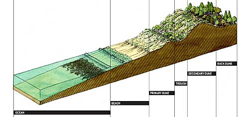
Another theory I subscribe to is the use of the ‘transect’ to design, plan, and build neighborhoods. The transect is an environmental research tool. It is a cut or path through part of the environment showing a range of different habitats. Biologists and ecologists use transects to study the many symbiotic elements that contribute to habitats where certain plants and animals thrive. The urban-to-nature transect outlines our human habitat in a similar fashion. See here: https://transect.org/index.html

natural transect
transect

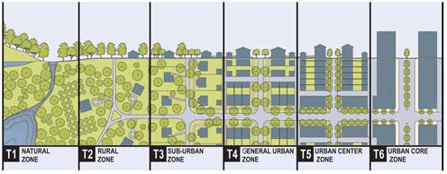
And the Transect Zones (T-zone) range from the most urban, T6, to the most natural, T1. And there are 4 other place types in between. The Transect can be used at the regional scale. For example downtowns are a region’s most urban, thus T-6, and State/Federal parks, T1, are the most natural areas that need to be preserved. Agricultural reserve areas (T2), edge of town suburbia (T3), small town centers (T4), and the middle of towns/cities neighborhoods are mixed-use (T5). And the Transect is best applied at the neighborhood scale.

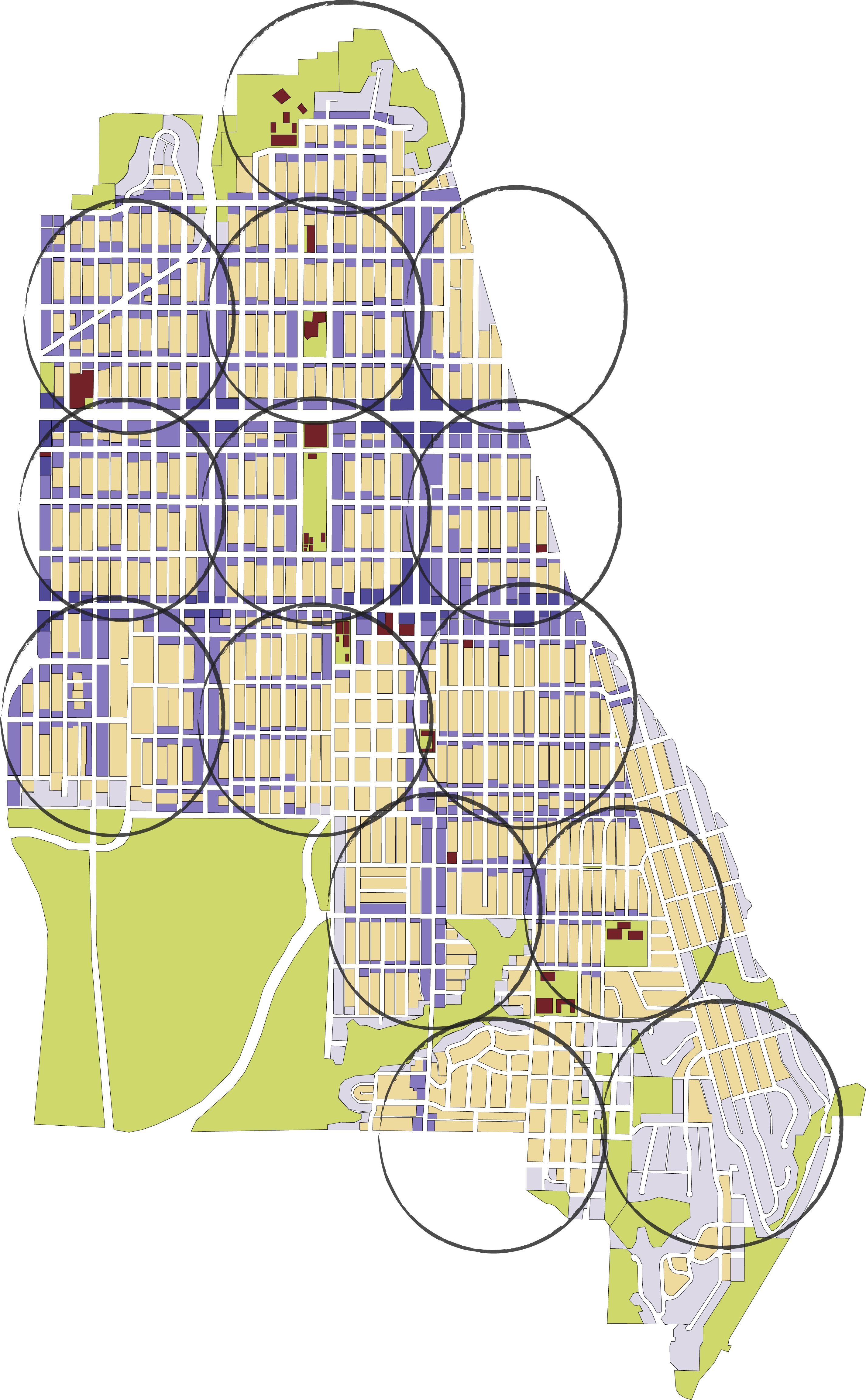
Each walkable neighborhood, approximately 120-acres, .25 mile distance from center to edge (approximately 1,250 linear feet), and these have at least 3 transect zones within it to provide a mix of uses, places, spaces, and people at different income/life levels. The neighborhood main street center is T5, the neighborhood general area with a few corner stores is T4, and the neighborhood edge is usually T3 that leads to natural corridor or the next neighborhood edge leading to another neighborhood and its main street center.

This my complete, walkable, mixed-use, transit-supported neighborhood with the 5-minute walk from the neighborhood center to edge outlined:

And here are where my local taco shop and trucks are located by Transect-Zone:

And here is the location of my next and favorite taco shop:

If I took the time, you’d see that my favorite taco shop is on the edge of the next neighborhood to my south. It’s center is located a neighborhood grocery store (Food Bowl, who make great tacos in their deli too). And our older streetcar neighborhoods in San Diego are expertly shaped with neighborhood centers located every 5 to 10-minute walks apart from each other and our #2 Bus stops. And, every neighborhood essentially has a great taco shop located in it. To the north, The Taco Shop is located another half-mile to the north, then another favorite taco shop, open 24-hours, Saguaro’s, is another half-mile from there.

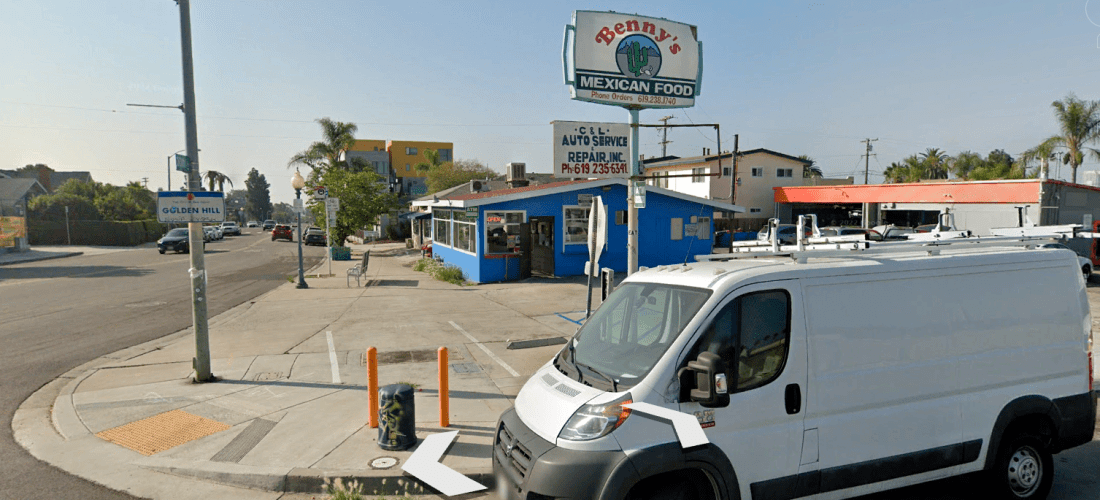
Below is a transect map of the neighborhood’s in the North Park Community Planning Area. My neighborhood is to the furthest south (and half in Greater Golden Hill). The Taco shop is on the edge of the next north neighborhood (see the off-set Upas St intersection). And Saguaro’s is on the edge of the next neighborhood to the north, and so on. Notice they’re all located on 30th Street, the only north/south street connected South Park/Golden Hill to North Park and all of the tacos shops are located on it (and Fern St where it changes names).

One of San Diego’s best cultural elements are our taco shops. When I travel somewhere for more than a few days and return… my first meal home is usually from a taco shop because I need it. And we’re fortunate enough to have a taco shop in most of our urban neighborhoods. I’m thankful for my local, but I eat there too often and it’s staled to my tastes… and it’s too close. A 5-minute walk to/from my house to my local taco shop only burns a few calories compared to the amount of calories served up by my favorite burritos, rolled tacos, and flying saucers.

The State of Land Policy in America

Economic Development

Recently, the Lincoln Institute asked readers to submit their best definitions of land policy. Being late, I offer the following that builds upon their submissions for your consideration:

Land policy is the rules and regulations that govern the use, ownership, and management of urban and rural lands. It involves both rational and emotional decisions about how the federal, state, and local authorities determine land uses, who are allowed to access to it, and what activities are permitted on it. These policies trend with our collective social consciousness between individual property rights and common public good at both national and local levels.

Land policy has both formal and informal outputs. Formal outputs are often plans, regulations, and programs. Informal outputs are often socially accepted patterns that shape our underlying cultural behaviors and social expectations. However, as stated in my previous blog, the federal, state, local land use policies are as misaligned as our current social and cultural malaise.

The study of land policy was founded during the early 20th century’s Progressive Era in response to economically and environmental instability generated by industrialization’s overwhelming amount of poverty and pollution. The rising tide of the new industrial age/era wealth was expected to lift all ships, but apparently only the steel hulled ones stayed afloat. As JP Morgan, Carnegie, and Vanderbilt’s robber baron class drove our lassiez-faire economic policies towards violent race and class warfare during in the Reconstruction Era that led to the reactionary, government led Progressive Era.

Land policies led to the establishment of local zoning controls in the 1930s/40’s. Then in the 50s/60s it was focused on urban renewal, and then environmental conservation in 60s/70s. In the 80s/90s it concentrated on redevelopment and economics. In our 21st century, it is focused on housing and social equity as our economy has again dramatically shifted, from industry to knowledge-based products.

And so here we are again today, wrestling with lassiez-faire Republicans supported by capitalist oligarchs’ whose exploitative practices influence our highest levels of government policies and manipulate our media markets. They form monopolies to raise prices, pay subsistence wages, and exert control over natural and public resources to amass extraordinary wealth. And our current Democratic-led social justice and equity era is echoing the Progressive Era’s renegotiation of social norms in the face of violent white, Christian nationalism… Ugh.

The GOP-led oligarchy system is being confused for authoritarianism. They’re not taking control; they’re abandoning the role of the government owning and managing the public good in trade for individual wealth creation. This is the state of Land Policy today…. the waiving of housing regulations while blocking the reformation of public housing to promote a supplyside, trickle-down response to chronic coastal city housing shortages. The focus on enabling regulatory-free development in transit areas policies without investing in transit supported infrastructure. And in economically static rust belt cities, nonprofits are expected to fill the void and role of both private development and public investments… Gah!

We’re experiencing a new land policy era in real time. North American cities continue to transition towards more human-scale urban development patterns in our post-industrial society, and even more rapidly post-pandemic. And our land policy should be leading cities and neighborhoods towards economic, environmental, and social equilibrium and away from the predominantly individual interests over our collective needs… C’mon.