Blessed are the place makers…

Uncategorized

When asked about what I do for a living by new friends and neighbors, I will start with “urban designer,” then drift towards “city planner,” and usually end up with, “sort of like architecture…” Or, during one those late Sunday evening angst moments while contemplating just what in the heck am I doing on this earth, I like to tell myself that I’m a maker of great places. Then Sunday’s infinite theoretical possibilities and dreams butt up against Monday’s unforgiving reality*, and I’m back to selling traditional neighborhood developments, form-based codes, consecutive-day charrettes, and mixed-use, walkable, urbanism to anyone willing to listen, which I enjoy immensely.

“I’m a PlaceMaker…”

That was a true statement for several years as the Director of Planning with the great PlaceMakers company. We delivered high quality traditional neighborhood developments, form-based codes, consecutive-day charrettes and mixed-use, walkable, urbanism to cities and towns across North America. It was Nathan Norris, working with Steve Mouzon, who coined the company name, Tom Weigel gave us his website, which is how I first heard it. Use of the name has grown due to the efforts of Fred Kent and his influential Project for Public Spaces group.

“I’m a place maker…”

Fred says that “Placemaking is a sacred community process.” In a web search I found a 1995 book, Placemaking: The Art and Practice of Building Communities, by Lynda Schneekloth and Robert Shibley, who define Placemaking as,” …the way in which all human beings transform the places they find themselves into the places where they live.” Which then led me to Fred’s iconic mentor, William H. Whyte and his studies on how humans inhabited New York’s various public spaces. Wikipedia’s definition states that it is both a process and a philosophy. How do I explain that to my patient neighbor?

“I’m a Place Shaker…”

A few years ago I was collaborating with the talented Beryl Forman when we figured out that an element of Placemaking goes beyond PlaceMakers’ visioning, coding and implementation services. A Place Shaker was something of a public relations, community organizer who focussed on neighborhood revitalization necessary to engage, connect, and collaborate with those who live/work/play on the street. Very smart elucidator, Scott Doyon, dug deeper into these distinctions and concluded that Placemaking was a constructive political act that physically changes our built environment and Placeshaking was the actions that build political will that sets the stage for real change, such as Park(ing) Day and Tactical Urbanism efforts.

“I make places…”

Indeed, I would agree that my job is both a process and a philosophy, as well as a professional practice, a life’s pursuit, daily grind, and a career of acres and acres of places only imagined… plus pocked marked along the way with a few built places that people enjoy (see my resume link above if interested in seeing pictures of a few nuggets). Today I work for Michael Baker International’s San Diego office, leading a new Urban Design Studio, which is an evolution of my profession as it seems every planning, design, and engineering firm now offers expertise and services in building mixed-use, walkable urbanism. It has been enjoyable watching the New Urbanism‘s advocacy for mixed-use, walkable urbanism also evolve over the past 20+ years from Quixotic idealism to matter-of-fact reality.

“This too shall pass…”

I find the evolution of these terms interesting too. As Placemaking, Sustainability, and Urbanism are now considered overused buzzwords and losing their meaning. Which is disappointing as my neighbor seemed to be just starting to understand what I did all day.

Photo: Mario Covic

Stop Talking about Density and Start Talking about Place.

Urban Planning

When I say, “density,” I picture a place like Little Italy. It’s a mix of townhouses, walk-up flats, small shops, churches, markets and restaurants. I can walk and bike around or drive my car when I want. I envision bumping into friends, enjoying our new Waterfront Park, drinking craft beer and eating from a variety of restaurants with a smile on my face. 

But, when I say “density” to my mom, who lives in the a country ranch house and rides horses, she pictures downtown towers filled with people, an outright oppression of her outdoor lifestyle. And to my granny, “density” means the Huffman six-packs looming over her North Park neighborhood bungalow. These are the hastily built six-or-so apartment unit complexes on single-family lots throughout San Diego’s Mid-City. Granny’s still bitter.

You can measure the density of all of those things, because that’s all density is: a measurement of how many homes fit within an acre of land. That’s all. An that’s all it should be.

My mom’s ranchettes could be between one home per 20 acres or four homes per acre. My granny’s bungalow is between eight and 14 homes per acre, depending on whether she builds a secondary apartment or “granny flat” in her backyard. The townhouses and condos in Little Italy are between 20 and 60 acres per acre, and downtown’s towers are 80 or more homes per acre. 

That’s how we use “density” to measure different types of homes.

But “density” cannot do more than that. It doesn’t tell us what we need to know to make decisions about the places we want to live, and it misinforms the development discussions we have about our future. We see this in our city needing all of sorts of other restrictions, aside from density, to create different places, such as suburban Sabre Springs, more urban North Park, Little Italy or downtown. We have to add in restrictions for height, setbacks, parking ratios and how the property can be used. These many other requirements are what makes a zoning ordinance an unwiedly tome, perfect for bedtime reading.

San Diego is now open for business and dreams of being a corporate business hub, but housing for middle management is hard to find an build. And, focusing on density alone skews the market for building homes we know we need and the market will build.

Community groups will demand the city’s planning department to keep densities artificially low in the hopes that it will keep new housing away. These lower densities intended to stop growth actually push developers towards building just enough very expensive homes to make their profits. These larger, more expensive units aren’t appropriate for our older streetcar neighborhoods. This creates an unintended consequence: introduction of a different building type that conflicts with a community’s character, or skips a step in transitioning from less urban to more urban.

And, high density itself does not make for better development. Density doesn’t tell us anything about context, such as being in located in the center of a neighborhood, or its edge. Neighborhood-scaled, modest, well-designed density is almost impossible to achieve because of all of those other restrictions mentioned above being out of sync with its context. 

Instead of addressing the issue head on – creating new codes and regulations that would allow the market to build a variety of housing types – we continue to rely on density measurements and conventional Land-Use Based zoning and hope for the best. So far that’s produced luxury towers, Huffman six-packs and large tracks of bland apartments in Kearny Mesa and Mira Mesa. The 50-year history of doing it this way has led to our collective mistrust in our neighborhoods between developers, locals, City Hall, and planning professionals. 

Density and land use zoning were borne of conflicts with the industrial revolution and propagated by old insurance companies’ discriminatory “redlining” practices against minorities in the 1930s. These companies outlined certain areas in red on maps and homes within these areas couldn’t buy insurance, which then became the neighborhoods where marginalized minorities were allowed to live. Having insurance allowed homes to become larger and more expensive, which came to mean lower densities in those neighborhoods. While these discriminatory policies have stopped, our current zoning and density maps reflect and continue old redlining practices to this day.

We need better tools to discuss how we build anything new in San Diego. 

I have long advocated for development regulations called “place-based codes” or “form-based codes” to replace the outdated zoning codes we use today. As seen in Denver, Austin, and Miami, they work better because they are built to help us understand that the type of places we want matters more than arbitrary measurements or ratios. 

We should allow the market to set how much retail, residential or office spaces there is on a given street. We should protect our valuable historic neighborhoods. We should control how buildings transition from new to old. We should understand how to transition between different types of buildings to maintain and cultivate a community’s character. It is clear that our long-held conventional approach isn’t achieving these goals, and we have new development tools that can do these things.

But focussing a conversation on “density” can’t. Remember, it is just a number.

(Thank you Andy Keatts for editing help. First published by Voice of San Diego here)

PAYING FOR THE PUBLIC LIFE

Urban Planning

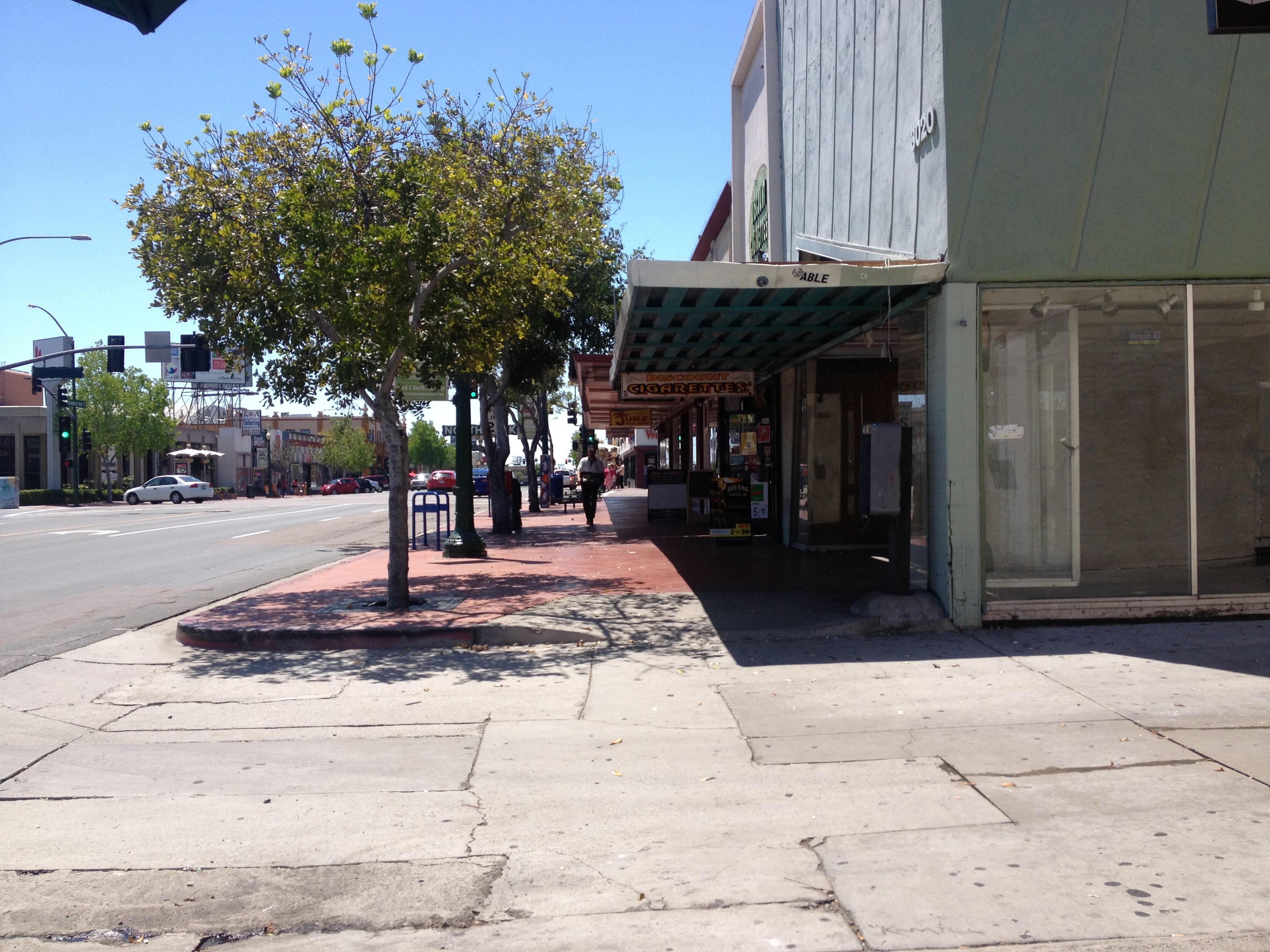
We understand that by paying our taxes we can leave our private home, in our private car, and drive down a public street, pull into a public parking space and enjoy a beautiful public park or shop on main street. Cities across the nation are trying to figure out how to finance the ongoing maintenance of these existing public services, utilities, streets and parks. This volatile political issue is in desperate need of innovative solutions as we only have two standard approaches today.

The primary approach, in overly simplistic terms, is cities providing citizens the “general benefit” of public infrastructure via taxes placed in its general fund. State funds and gas taxes fund a majority of our street maintenance. This year, our city of 1.3 million people will generate $1.18 billion in taxes/fees and will use approximately 18% of that to maintain 35,000 acres of parks and 2,800 miles of streets. Additional regional/state/fed revenues help to pay for streets along with new development fees and construction requirements. For reference, police and fire protection costs approximately 68% of my city’s total tax revenue.

The other approach Californians have is the ability to vote for Maintenance Assessment Districts (MADs). Assessed property owners are levied an extra fee on their annual property tax bill to pay for “maintenance of district-wide public facilities.” This increased service is called a “special benefit” beyond the City’s basic “general benefit.” These properties are paying for the public life.

The purpose of a MAD is to generate money to pay for public services. These include the upfront installation and long-term maintenance of parks, landscaping, rights-of-way, street lighting, security, flood control, and stormwater drainage. MAD districts are formed with a higher upfront tax to pay for installation, which is then dropped after two-years to pay for maintenance over many years. In 2015, the city of San Diego’s Parks and Recreation Department will spend $35 million maintains services 62 individual MADs in perpetuity.

The advantage of a MAD in California is that our property taxes are capped under Proposition 13, but MAD funding is outside of this cap so MAD revenues fund MAD projects, and not siphoned off to Sacramento. Another advantage of MADs is that these self-funded districts are protected from the economic pendulum swings that affect municipal budgets. 

The disadvantage of a MAD is that a public vote needed to raise the assessment. It is always considered politically difficult to raise taxes. In addition, due to dropping assessments over time and keeping them at the same rate over many years, older MADs typically underfund the maintenance necessary to keep up with the expected quality of the service.

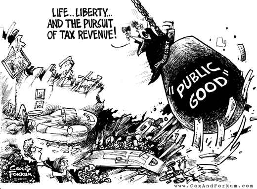
PARKS DON’T PAY TAXES

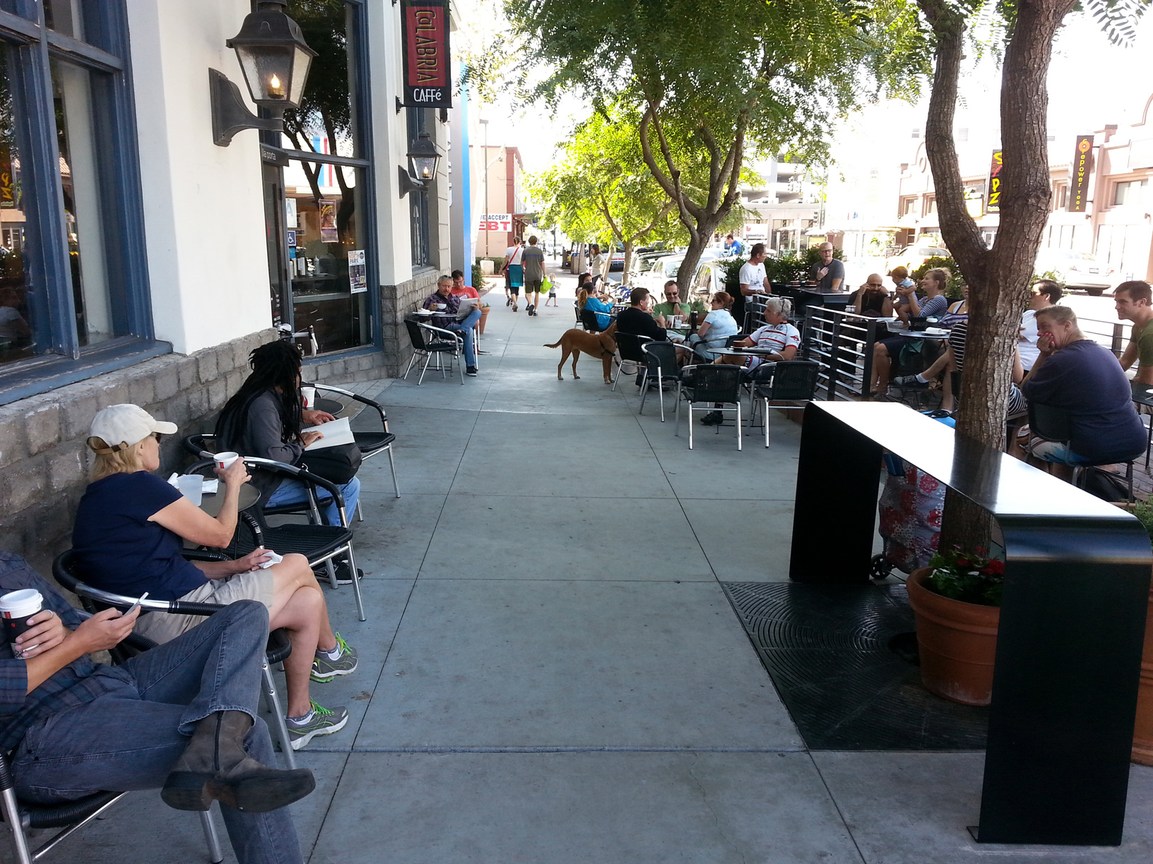
When planning a long-term investment, it is easy to lose track of how valuable public spaces are in terms of social equity, environment protection, and economic value. Frederick Law Olmstead conducted a study from 1856 to 1873 to track how the City of New York’s initial $13 million investment created a $209 million increase in property values on private land immediately adjacent to Central Park. This increased value stands today. As a rule of thumb, private property is 10 – 20% more valuable when fronting onto a civic space.

While we have well-known rules regarding a city’s inability to ‘take’ property value, we have fewer options for a city’s ability to ‘capture’ increased land values due to the public investment of a new public benefit. To spur economic growth cities tend vacillate between short-term direct financial incentives that subsidize private development (tax exemptions, loan programs, expedited entitlement processing, investing in convention centers and stadium for example) and longer-term investments in public infrastructure (via Development Impact Fees, acquiring land, and building new civic spaces for example). With California leaving the Tax Increment Financing (TIF) for Urban Renewal era, we are now on the cusp of a new self-taxing Infrastructure Financing era, which will need innovative models.

NEW MODELS

The first is a newer MAD model. Since 1994, California has allowed for Property-based Business Improvement Districts (P-BIDs), but few cities have participated in the program. Conventional Business improvement Districts (BIDs) generated revenues from business license fees. These property-based tax assessments are approved in shorter 5-year increments, and are therefore more flexible in increasing, decreasing or eliminating property assessments. These P-BIDs are also more responsive to funding building to maintenance and operation set in specific master plans agreed upon by local stakeholders and city planning departments.

Second, the governor just this week signed SB 628, to update our Infrastructure Financing District program. Cities are able to establish a district, adopt an infrastructure financing plan, issue bonds, and fund projects through tax increment financing upon approval by 55% of the voters. These are intended to be a new era redevelopment districts that finance public capital facilities, brownfield restoration, environmental mitigation, low income housing, transit priority projects, and projects to implement a sustainable communities strategy. With the new low voter threshold, from the 2/3rd majority, these districts should become very popular with cities working to leverage the value of its transit investments.

Third is the Lean Urbanism concept introduced by Andres Duany. Being Lean means to reconfigure the future of urban planning towards lighter, quicker and cheaper approaches to development and entrepreneurship in order to deal more agile with the limits of the 21st century. Lean Urbanism is about innovation and allowing City Halls to streamline the processes that hinder socioeconomic development. These types of places exist in slightly different forms in new Innovation Districts/Zones created in San Francisco and New York. These municipalities recognizes that to appeal to new technology markets it must act in a hands-off fashion as these innovative markets change faster than large municipalities can adjust to.

And fourth are Decision Districts. Admittedly my idea, these districts would reconfigure conventional top-down planning department entitlement and financing processes into neighborhood-based mini-planning departments that coordinate public realm streetscape elements (parking, street trees, walkways, signage, lighting, and encroachments) directly with adjacent private realm elements (building frontages, shopfront improvements, entrances and ground/upper floor building functions). Located one lot deep on a Main Street or neighborhood center, these Districts would self-permit and generate fees to supplement P-BIDs, economic development programs, and Main Street Associations. The goal is enable local authority to implement a specific district-level master plan over a set period of time.

MORE, PLEASE

Our cities have the opportunity to craft new financing tools that better reflect our cultural shift towards walkable, bikable, lingerable, sitable, and public transit supported urbanism. Moving from the older, larger-scaled, slum clearing, urban renewal models towards finer-grained financing tools is necessary to build and maintain more complex urban places. For we understand that building towards the social and cultural value found in parks, streets, transit stations and main streets enables our cities to continue generating economic value in the 21st century.

City Planning’s Balancing Act

Urban Planning

A city makes many investments, such as infrastructure improvements, life and safety services, and in their employees. To fund such, cities rely upon new development and construction to fuel its economic generation engine with new jobs, housing, shops, parks, fees, and tax revenues. We all know too well the difficulties to build new development in Southern California, as cities usually have to overcome a history of segregated land uses and allowing deplorable new development in our older neighborhoods that challenged its valued character.

All new public and private development is guided by city policies, rules, and standards. New development is valued by cities as financial investments and economic generators to pay for city services, such as streetlights, fire trucks, and retirement pensions. Cities basically have two development-as-investment tools.

The most common tools are found in citywide rules that allow for new development to happen on private property without city review beyond building safety inspections (by-right). These rules are outlined in the General and Community Plan policies and within Zoning and Subdivision regulations. It must be noted that cities allow any property owner to request changes to any of the above rules through a risky and expensive decision-making process (discretionary review). Because of this expense, it is usually well-financed developers with large-scale projects who apply to amend these rules, which make these proposals politically volatile, polarizing, and well documented in the local press and local blogs.

The other investment path is found in city-targeted areas for new types of developments, such as new transit station areas, convention centers, or sports stadiums. These tools are found in Master Plans, Corridor Plans, and Specific Plans, which are vetted through an onerous environmental impact review, multiple city decision-making boards and commissions, and finally with a City Council vote. While the by-right development tool is an easier path, these city-targeted projects usually have local political backing to be built.

In addition, the State instructs California cities to continually update their General and Community Plan policies and requires that these be both internally consistent with each other as well as in alignment with more detailed Zoning and Subdivision regulations. All of these updates must be “disclosed” through the California Environmental Quality Act review process, which we all know and love to manipulate. For example, unions challenge projects to ensure labor contracts; environmental lawyers threaten lawsuits to enrich their cause; and, neighbors will argue “water supply” as proxy to not allowing any changes to happen in their community. Because of this reality, these city-initiated policy and regulation updates are politically volatile, are rarely updated, and rarely in conformance.

Unfortunately, when these convoluted by-right rules end up staying on the books for generations, such as segregating land use born from historic insurance redlining practices, they make present-day development models illegal and very difficult to build. Because this circle of planning life is admittedly broken and difficult, developers and cities prefer to negotiate directly with city leadership.

Honestly, new development changes a neighborhood, either gradually or radically. Californians are fortunate to have a high quality of life, and change can be a very real threat to such. Because change is fearful, local citizens are seemingly against all new development, which as noted above is allowed by right, by amendment, or by city initiative. And while change is constant in our cities, we all want to manage that change in order to limit its risk, leverage its value, and fulfill its expectations. I know this because I am raising teenagers.

An important question to be answered is, “does the fear of change outweigh the pain that new development intends to fix?” For example, while there is consensus on the need for attainable housing in southern California, is it worth an oversized, out-of-character apartment block to achieve it? In answering this question, a city’s planning staff is often seen as the agent of change to be vehemently opposed, rather than as a mediator for vetting proposals.

I believe this is because the general public has a hard time understanding the nuanced difference between a privately initiated development proposal and a city-initiated development proposal. Most folks do not understand that private landowners have the right to make a proposal and that city planning staff must respond and process it. Add in the city’s convoluted planning processes, and too many folks end up not trusting any planning efforts, projects, and proposals. Opposing new projects is now sport, with cheerleaders, players, and scorecards.

The lost art of the planning profession is in aligning short-term private development proposals with long-term public investments to realize a city’s vision, goals, policies, and rules. The great recession revealed how many cities dismissed the value and role of planning in generating economic development. They formed blue ribbon committees to cut red tape and scale back policies, regulations, and staff, deemed to be in the way of new investment. While these cities held private investment in a higher regard than public investment, good city planning practices teaches that both are necessary for a city to thrive.

I suggest the planning profession track the quick transition of Redevelopment Agencies from 1950’s urban renewal practices towards 2015’s infrastructure financing mechanisms. A standard practice for 50-years, redevelopment is now being realigned with the cultural shift of people today wanting to live, work, play and shop in older, urban neighborhoods. Urban blight has been replaced by finding money to fix our crumbling streets, sewers and transit systems. If planning continues to use its same long-standing planning practices it will continue to marginalize its value and be misunderstood and mistrusted by residents and politicians.

Former City of San Diego Planning Director, Bill Fulton, and current City of Los Angeles Deputy Mayor, Rick Cole reinforce these points here and here.

Urban Treasure Hunt

Urban Planning

I am fortunate to have a close-nit group of urban advocates who like to tell great stories, share both successful and failed design experiences, and argue about our city’s future over a few craft beers. Time spent learning from Mike StepnerDavid McCullough, Kevin Clark, Pauly DeBartolo and David Saborio is invaluable. At our last soiree, the great Frank Wolden, told his most meaningful public process story.

A few years ago, Frank was leading a series of workshops for an older San Diego Main Street revitalization plan. The once vital Main Street had emptied out with the advent of the regional mall. It became mostly vacant and lacked any new investment or interest. Frank was in charge of coming up with a plan that would make anything new conform to the surrounding neighborhood’s ‘community character;’ which seemed unlikely.

His task was made even more difficult as a few too typical Not-In-My-Back-Yardigans were disputing the need for anything new during the workshops. This is because anything new represented change and change equated to fear of the unknown. This fear of the unknown was greater than the inconvenience of empty shops (they could easily drive to the mall). In fairness, San Diego is quite nice and there really isn’t enough pain around here to instigate great demand for change. It takes a lot of effort to simply hang on to what we’ve got. So, a frustrated Frank had an idea to change the dialog and get these folks to talk honestly about the state of their neighborhood.

He gave them homework.

For the next meeting, Franks asked locals to bring pictures/images of their local “Urban Treasures.” As expected, the Treasure Hunt was illuminating in the images people presented. Presentation after presentation quickly revealed that there was very little to ‘treasure’ in and around their local Main Street, beyond patina.

Main Street was a mess and had been neglected for too long. Something had to be done…

A once a bustling Main Street well-used today.

A once a bustling Main Street…

Auto-oriented streetscapes left little for daily users to enjoy.

Auto-oriented streetscapes left little for daily users to enjoy.

With this exercise, Frank was able to free up the public discourse by acknowledging a simple truth… There wasn’t much to love, cherish or treasure there. And, therefore it was possible that something new could actually improve the place they live, work, shop, play, worship, socialize, and dilly-dally around in. So at that point the conversation on a plan began in ernest.

I understand fear of change in San Diego as we have a ‘precariously’ high-quality of life. Anything that raises or lowers our property values is a very real threat to our long-term financial well-being. I made this point last week on Voice of San Diego Radio (at 22:08) while discussing density and the inflammatory dialog surrounding new transit station area plans.

My hope is that a public dialog on anything new begins with an honest assessment of the current context. What is really there today? Once we get to that point, then I believe urban designers and planners can assist in realizing a community’s ‘character.’ As that character is found in local resident’s memories and expectations, as well as its treasures shared with visitors and each other every day.

Understanding San Diego’s precariousness, I see today that smaller design interventions are making the biggest impact on how people see the value of investing, evolving, and engaging in their neighborhoods. With this, my favorite planning adage, “this too shall pass,” now fits nicely with Frank’s biblical lesson, “ye shall know the truth, and the truth shall make you free.”

San Diego's only Parklet is in this same neighborhood. Thanks to Karen Goyette for use of the image.

San Diego’s only Parklet is on the Main Street Frank studied long ago. Thanks to Karen Goyette for use of the image.

Small Treasures make a big difference in our neighborhoods.

Small Treasures making a big difference as found in a Pop-up library.

Thinking Aloud (and on TEDx and beyond) About San Diego’s Urbanism

Urban Planning

I’ve been fortunate to have been invited twice to speak about my ideas on urbanism at San Diego’s TEDx American’s Finest City events.

The first one was held in 2012 at Scripps Oceanic Institute (Walter Munk is a true American hero) and was on my thoughts on how to code/build towards a local community character in post-redevelopment California. The idea originated from a week Leon Krier spent in San Diego and his approach to creating a ‘there, there.”

Coding for Character TEDxAFC

The second one was held in 2013 at the NewSchool of Architecture + Design. This talk was on my ideas of San Diego’s next urbanism, after the suburban exodus back to downtown. As always, inspired by Leon Krier, I see our culture becoming more secure with urban living. Plus, our cities are built upon trends and urbanism is simply the latest.

http://dai.ly/x2p9o4a or http://dai.ly/x2p9o4a

Other videos of my thoughts are below for your viewing pleasure:

https://www.nbcsandiego.com/news/politics/WEB-POLITCAL-SPEAK-SEG-1-5-3_San-Diego.html


One Block at a Time…

Urban Planning

In an era of austerity when our bridges are falling, levees failing, and streets crumbling, cities are coming to the harsh realization of the difficulty and economic importance of simply maintaining our existing infrastructure. The conflicts we are experiencing today are due to states and cities not being able to afford razing and completely building new bridges, storm drains and thoroughfares to replace failing infrastructure, and yet our regulatory and construction standards have not adjusted to this new reality. We are painfully relearning the value of “efficiently built infrastructure” and its effects on our quality-of-life, as well as its effects on our prosperity or failure of older places.

In order to increase the efficiency, speed and perceived freedom of the automobile, we narrowly focused too much of our money and resources on building cultural wastelands. Our most recent generation is rejecting their parent’s suburban lifestyle and the well-known social and health issues these placeless-places churn out. The 21st century is witness to the theoretical end to the historically devastating Urban Renewal policies and programs formulated during the mid-century modernist era. Following the national public backlash over the 2005 Supreme Court decision to support eminent domain over the Kelo vs. New London (Connecticut) case, the State of California rescinded its long-time Redevelopment Agencies. Most agencies across the nation have limited their redevelopment authority to non-residential districts, thereby being careful to not repeat California’s course.

Kelo_cartoon

California’s general public didn’t blink when Governor Brown shut down our state’s Redevelopment Authorities.

The national discourse on urbanism has thankfully evolved from slum clearance for economic development towards building longer-term value through cultivating a community’s distinctive character. This recognition and ongoing respect for a community’s enduring characteristics are, as Ken Greenberg wrote in the Charter for the New Urbanism, “legitimate shapers and influencers of what is to come next.” After 30 years of New Urbanists making the argument for nurturing and cultivating our historical building fabric, this more pragmatic role of stewardship is now being directed towards our city’s infrastructure. This shift from relying on singular “level of service” measurements towards a more localized expectation for holistic “place making” is deeply resonating with Americans.

From simple and safe to complex and connecting (Image by Howard Blackson)

From simple and safe to complex and connecting (Image by Howard Blackson)

The Next Generation (NextGen) of urban advocates are breaking the cyclical pattern of tabula rasa. Rather than repeating the cry to raze vacant suburban office parks, strip malls and super centers in order to build anew, the NextGen’s Tactical Urbanist are experimenting with tools to re-inhabit and re-purpose placeless-places. The Sprawl Repair Manual, Retrofitting Suburbia, and Sustainable Urbanism are nationally published guides to effectively apply short-term, human-scaled, actions to making long-term improvements to our quality-of-life one block, one street, one building, and one neighborhood at a time.


WORK: Third Avenue Plaza

Urban Planning

Microsoft Word - HB3Resume 051514.docx

In 2012, at the request of Chula Vista City Council members, I led the city’s Traffic Department through a Planning Consultant role to revise a downtown streetscape plan into a new plaza.

A public charrette and stakeholder meetings led to the design of a plaza to host a Veterans Museum, Market Hall, fountains and seating. Third Avenue traffic calming allow pedestrians ease of access and new sidewalk dining areas.

WORK: Plaza de Panama, Balboa Park Advocacy

Urban Planning

Microsoft Word - HB3Resume 051514.docx

In 2013, at the San Diego Mayor’s request, I assisted the City of San Diego in reconceptualizing the removal of 57 parking spaces from the heart of Balboa Park. Continued to provide urban design technical assistance as for the park through my role with the City of San Diego’s Civic Innovation Lab.