Hurricane Katrina

Climate Adaptation Audits: 10 steps to evaluate risks and adapt to climate calamities

Climate Action Plan, Urban Planning

How can communities plan to become more adaptable and resilient in the face of climate calamities, such as wildfires, hurricanes, drought, heat waves, and floods? One idea is to start with an audit. Using Jeff Speck’s successful 10-part “walkability plan” as a template, I wrote a list of steps that a community could use for a “climate adaptation audit.”

The 10 steps below are grounded in the principles of New Urbanism, which are based on the design of cities and towns that have survived for centuries. Compact, walkable places are more resilient, but they also need to respond to modern conditions and the science of climate change. 

The ten audit points aim to give towns and neighborhoods a chance to make living on earth attractive to a broader range of people. These are all applicable to any location, and a community that checks all of these boxes should be “climate calamity ready.” Using this audit, residents can see what they need to prepare for and how to align resources.

  1. Inform the public of climate adaptation activities, encourage citizens to become involved in the planning process, and engage in broader professional discussions and information at local, national, and international levels. 
  2. Understand your local context’s climate risks to be used as baseline data for a Climate Adaptation plan (use the Place Initiative tools Community Assessment Guide). 
  3. Determine local consensus on a long-term vision, choosing to either permanently retreat, temporarily evacuate, and/or harden against climate calamities. Facilitate cooperation among citizens, public interest groups, non-governmental organizations, and governmental agencies to shepherd plans and policies toward envisioned outcomes (to retreat, evacuate, or harden from/against weather/fire/water/earth). 
  4. Apply New Urbanism’s best practices to determine if new/future development is best directed in the form of infill, town extension, and/or a new town to shape continual development at a human-scale in response to the region’s changing social and economic needs. (Diagramming new urbanist principles, outcomes, and results is needed to improve calamity resiliency).
  5. Enable place-based policies, standards, guidelines, and plans that employ the highest standards of New Urbanism best practices (mixed-use, walkable, transit-supported) urban design and planning to define and advance the local municipality’s interest in long-term social and economic viability. 
  6. Set a by-right approval process in place for projects and applications for approval that are consistent with civic policies and interests (a non-discretionary approval process reduces the power of bad actors to reject projects that address climate resiliency).
  7. Set a straightforward discretionary review process for proposals and applications that are subject to council or supervisor approval to determine whether they are consistent with the civic policies and interests. 
  8. If retreat or evacuation from identified climate calamities is required, determine the type of calamity, its context, emergency routes, destinations (and alternatives), and who is responsible (fire marshal, city manager/mayor). For example, if there is a wildfire in a mountain context, with clear (lighted/reflective) signage for routes to safety (state highways, local roadways), and design the route for this climax condition, such as fire truck access and directional lane adjustments. 
  9. If hardening from climate calamities, identify the type of calamity, its context, types of response (and alternatives), and who is responsible (building and development services manager). For example, if there is a wildfire in a mountainous area, build with fire-safe codes, with overlapping zones of defense around clustered compounds, allowing for firefighting from the roadway. Make space for wildland firefighting (no new sprawl) and structure firefighting in clustered compounds. Do the same for flooding, sea level rise, and extreme weather conditions (See Martin Dreiling’s 2010 Fire Mitigation in the Wildland Urban Interface SmartCode module). 
  10. Choose a capital Improvement Plan that prioritizes the path of least resistance to determine where spending the least money would make the most difference and build from there. For example, fund, maintain, and operate tactical “communication command control centers” to be deployed immediately for disaster recovery.

While communities have been planning for climate resilience for some time, the idea of a step-by-step audit grounded in sound urban principles makes a great deal of sense. Please let me know your thoughts. 

Note: A recent CNU webinar on “Climate-ready communities” discussed state and provincial policies and tools. The author, an attendee, suggested the “climate adaptation audit” tool, and it generated interest.

Climate Adaptation – Wildfire

Climate Action Plan

In 2002 – 2003, north county San Diego’s Harmony Grove was a chicken ranch that was closing due to Newcastle disease and would vacate 350-acres on the edges of Escondido and San Marcos. It is highly prone to Santa Ana wildfires traveling up the Elfin Forest’s Escondido Creek valley, from west to east. In 1996, a terrible fire roared up the valley and local residents were willing to trade a new well-connected, compact community, with homes on small lots, parks, and future shops with two roads in/out in case of wildfire, for the vacant chicken ranch. What they opposed was large-lot suburban sprawl on the hillsides that was more susceptible wildfire.

Working as a Project Manager on the General Plan update for the County of San Diego, we designed and entitled a village center, home of a new fire station. And we followed this wildfire adaptation audit process to harden the urban/wildfire edge by building with enhanced fire-safe codes, overlapping zones of defense around clustered compounds, enable firefighting from the roadway. Make space for wildland firefighting (no new sprawl) and structure firefighting in clustered compounds. 

The only step missing is the administrative or by-right development process that fits into the original village plan. The images below are of our initial workshops with the community to envision what should be built and where, the diagrams and plans, and what’s there today, 20+ years later:

(from Fire Mitigation in the Wildland Urban Interface, Martin Dreiling, https://transect.org/modules.html)

Whatever...

One Size Fits One… (and it’s the worst one)

Transit, Urban Design, Urban Planning, walkability

The ubiquitous space, shape, but highly volatile speed of the car is much larger and faster than the universal space, shape, and speed of a human. Yet we continue, since post WW2, design and build everything and everywhere for space, shape, and volatile speed of the car. Streets widen, ground floors are parking lots, people are pushed towards the edges, and cars dominate our landscape. This is what ruins downtowns and isolates small towns. Cars are a suburban mobility tool.

That’s not say we need to ban cars. They do somethings great, such as get lumber, while not as good at others, such as exercising. The fact is that cars are best served for disparate suburban expanses. Walking, transit/buses, and bicycles work best in more urban areas. Cars work great in shorter-commutes and throughout suburbia. Trains, airplanes, and ships work best for long commutes.

The New Urbanism was new because it worked to humanize the car in cities, small towns, and new towns. We’re now moving into the Next Urbanism (and I write about this throughout this blog and speak about on podcasts, such as Kevin Klinkenberg’s Messy City). And as humans, we should be designing and building everything everywhere to accommodate for humans first, letting the right mobility serve us throughout the spectrum of urban to rural contexts.

Downtowns (regional centers) are marginalized by our 1.5 cars per person maxim (Spend 5-minutes walking around Downtown San Diego). Small towns are isolated by freeway by-passes, which need both regionally accessible cars and local people to be economically viable (think Ramona, Julian, and Jacumba, if in San Diego). The industrial era invention of cars and suburban sprawl go hand-in-hand, the built each other. Unfortunately, both cars and suburbs are inhumane and detrimental to our economy, environment, and cultural cohesion (See Sabre Springs).

The next urbanism means making downtowns less car-oriented, small-towns car-supported, and car-happy suburbia having sub-regional centers that are more urban/humane. This place, a small district in Tempe, AZ, Cul-de-Sac, is an example of the Next Urbanism… building more urban, sub-regional centers in the vast sprawl of suburbs surrounding downtown’s regional center. And, by the way, Opticos Design, Inc. is one our best architecture and coding companies.

Leon Krier was Right

Leon Krier, philosophy, Urban Design

My most significant educational experience was sitting directly across from Leon on a 5-day charrette in Chico, California, 22 years ago. The intense time spent with him changed the trajectory of my professional life… because Leon Krier was right.

Ye shall know the truth, and the truth shall set you free.” – Jesus

Leon was a man of great character, who was the largest influencer of my education, as far as any single person could have affected it. Another iconic person (of whom I can never repay for their professional generosity and genius), Andres Duany, wrote this loving eulogy that correctly identifies the voracious and tenacious conviction of Krier’s work in contrast to Leon’s gracious, admirable, and courteous lifestyle. His life’s story is well documented. His uniquely lived experience of growing up in Post-WWII reconstruction Luxembourg, combined with his informal education (he learned from mentors and teaching at London’s Architects Association) as processed through his complex character (see Duany’s description above) shaped his incredible creativity.

Leon correctly identified that industrialization had devastated our civilization and its buildings and cities. Krier was the first to challenge the modernist dogma in the 70s as young architect. Because of his lone advocacy turning into a movement, today we have a fuller spectrum of design choices, from self-referential modernism to traditional vernacular to classically ordered tools. Leon Krier was right.

A few years ago, upon picking him up from the airport, I immediately drove Leon to share my disdain of the latest modernist infill project in my turn-of-the-century streetcar neighborhood. It’s a copy of Corbu’s Villa Savoye that had been in Architecture Record. I was fully expecting an affirmation of my disgust when Leon surprising said, “It’s good.” My eyes widened and my hands gesticulated wildly as I explained that the building’s fenestration was backwards, completely ignored its context, and the urbanism only existent in materials and scale. Leon agreed that while all I said was true, for a modernist building it was a very good example.

The lesson being, “If you are going to do modernism (or anything for that matter)… then do it well.”

I had forgotten how difficult it is to get any building or nice place built. My New Urbanist dogma had gotten in the way of this human truth. He said that to build anything in today’s toxic environment (naturally and politically) was laudable and then to build it well was meaningful. Leon Krier was right.

I am fortunate to have spent days and hours talking with Leon while driving across US west deserts, working in San Diego, and online during Covid. While his professional works is polemic and absolute, his personal perspective was equally optimistic and positive. Another grand lesson I learned from Leon on the importance of what we do was that, “The architecture the city and public spaces is a matter of common concern to the same degree as laws and language; they are the foundation of civility and civilization.

It was a feast to have learned these truths from my genial mentor. Thank you again, Leon.

[This week my lovely daughter in London posted this in front of the Architectural Association]

The Mid-21st Century Economic Development Model

Economics, Innovation Districts, Urban Design, Urban Planning

My treasured colleague and mentor, Bill Fulton, is creating our brave new post-pandemic world’s econ dev model that is a dramatic shift in how we are socializing into the mid-21st century. You can find his writings about his approach on his Substack page. He’s clearly identified and defined the patterns within the urban core/center and general urban areas and I’ve merely added the rural component to complete the ‘transect’ of econ dev place types.

Our state-by-state policy shift towards mixed-use, walkable urbanism is finally complete. Every city across the nation has general or comprehensive plan policy that allows for urban infill development. But this process has taken 30 years and the promised transit to support this new urbanism hasn’t been funded, and now we are in a new socializing era. We didn’t plan for the unintended consequences of a global pandemic… that low-density, auto-oriented, suburban homes would become mixed-use, live-work buildings.

We didn’t plan for urban downtowns to have less work and less shopping after building more housing. We didn’t plan for the cultural backlash of electing a black President and burn down our federal government and defunded our education and the transit infrastructure rather than our police and military state. Oh well… “you get the government we deserve,” said, Andres Duany once.

So here we are again in need of reforming our new urbanist, after-suburban sprawl, 20th century urbanist policies and regulations to be to meet today’s social demands. This zoning reform transitions from noxious industries co-location needs to regulating obnoxious neighbors sharing amenitized downtowns and sub-regional urban centers.

The following are a regional and citywide policy and econ dev framework for lot and block scaled zoning/regulatory reform:

Regional and Sub-Regional Urban Hotel (Transect Zones T6, T5, and T4-Neighborhood Centers)
Offers amenitized live, work, and play facilities for hyper-locals (new infill housing), locals (suburban commuters), and visitors (hotel business/pleasure). Dollars are flowing in from these types of citizen consumers.

Private Buildings and Spaces Functions
– Retail – Dining and Entertainment, and Shopping
– Daily Needs Services – Gym, spa, sundries, bodega, rentals
– Office Facilities
– Hotels (Long-Stay)
Conferencing Facilities
– Hotels (Short-Stay)
Pools, spas, gyms
– Homes – mix of uses (working and living)
– Paseos – Access between spaces and buildings
– Belvederes – Roof decks and garden terraces
– Parking Areas – Access to spaces and buildings

Public Buildings and Spaces Functions
– Conference Center
– Plazas/Squares – Destination civic space, active and contemplative
– Civic Services – Library, Post Office, City Hall, Pool

NGO Buildings and Spaces Functions
– Chamber of Commerce / Meeting Rooms and Facilities

Suburban Workshop (T4 General, and T3)
Offers live, work, and large-scale play facilities without amenities in existing suburban communities. These are static places with low-growth, and little change the appearance of the pods of housing or commercial or industrial. Auto-oriented but adding work from home and people wanting to walk around for exercise, post-pandemic.

Private Buildings and Spaces Functions
– Single-family Detached Homes
– Accessory Dwelling Units
– Yards

Public Buildings and Spaces Functions
– Ballfields

Regional Rural Substructure (T2)
A zoning conflict we’re addressing today are the regional infrastructure and utility issues bumping against either the suburbs or smaller, historic towns. Agriculture being the original regional utility/commerce.

Private Buildings and Spaces Functions
– Energy – Solar, wind, electrical (Efficiency Issues)
– Substations, powerlines (Wildfire Issues)
– Data Center Districts (The Next Big Deal to Deal with)
– Agriculture lands, Farmsteads, and Farm Worker Housing (Resort Districts)

Public Buildings and Spaces Functions
– Freeways, Highways, Corridors
– Federal and State Parks

Preserved and Pristine Nature is T1

That's Entertainment!

South Park’s Porchfest 2025 – A Community Connector

Public Space

Beginning in November 2016, the idea of South Park’s Porchfest (to have the kids play music on their streets without permits, red wristbands, chain link fencing, blue porta potties, and security guards) was stolen from Decatur, Georgia, who borrowed it from Ithaca, NY. San Diego is relatively bereft of live, outdoor music in our streets, bars, and restaurants. Axios San Diego wrote about tomorrow’s Porchfest here, using a few quotes from this blog and pictures I’ve taken over the years.

One of our family favorite outdoor events, the New Belgium Beer ‘Tour de Fat’ Festival, hosted a fun bicycle parade through South Park/Golden Hill that was always soured at the end in Golden Hill Park by the unnecessary separation of adults and children by chain link fences, security guards, and wristbands… because adults can’t be trusted to take care of kids. San Diego’s Special Event Permit requirements ruined the spirit of an outdoor, walking around, and bicycle parade music festival out of fear of mixed beers with kids.

My wife Kristin and I, and our neighbors, Jen and Brian Spencer, had young kids who we wanted to share live music outdoors without fear of each other and decided to try Porchfest. And it worked. People, young and old, played and enjoyed music on a Sunday afternoon. We went from neighbor porch to porch listening to performers and bands of all skills and ages. Nobody has been hurt, and we’ve organized 8 or 9 of these over the past 9 years.

Our initial goal of having my kids confidently perform in front of others is complete, and they’re now off in college and beyond. My hope for today is for more neighborhoods to borrow the idea of socializing with your neighbors share these experiences. The kids are alright, and they are really great at playing music, making art, singing, and performing. Really alright are the Night Carrots, the best kid band to get their start at our Porchfests.

In our neighborhood we share this experience and talk of it with each other often. We talk about plans for the next one and our experiences from the past. From this we’re fortunate that a new idea has sprung from Porchfest, a Halloween haunted house is now happening annually down the street. That’s the big idea… getting together and daring to be outdoors in beautiful San Diego.

Seville

Controlled Complexity is the Spice of Life

philosophy, Urban Design

This headline/article was in today’s The Overhead Wire, “Complex urban streets encourage safer driving.” Yeah, when you take the complex river and stuff the water flow into a culvert it reduces the complexity and the energy is drained quicker… adding complexity keeps the energy stored in the system/network/place. This is stated in the 2nd Law of Thermodynamics, as analysed by James Howard Kunstler in his fourth non-fiction book, The Long Emergency: Surviving the Converging Catastrophes of the Twenty-First Century,

“... ordered flows drain entropy at a faster rate than complex disordered flows. Hence, the creation of ever more efficient ordered flows in American society, the removal of constraints, has accelerated the winding down of American potential, which is exactly why a Wal-Mart economy will bring us to grief more rapidly than a national agglomeration of diverse independent small-town economies. Efficiency is the straightest path to hell. (p.191)”

Yes, the more complex a river, a street, an economy, and our lives are, then the more energy we have within them to savor, enjoy, and experience them. It’s when we’re shopping in a Wal*Mart, walking along a box culvert creek, driving on a freeway, and being isolated do we more quickly entropy and lose our energy. Now, that doesn’t mean we thrive in chaos and disorder, we need both. But not just one or the other. In places of great chaos, more order achieves thermodynamic balance. In other places of great order, more chaos helps it achieve its equilibrium. This achieving equilibrium, between complexity and simplicity / chaos and order, is the basis of my economic, environmental, and social equity philosophy.

Leonardo Divinci's City Plan, "BE COOL."

The #1 Reason for Zoning Reform: People are Obnoxious

Uncategorized

Missing middle housing, and similar ideas of gentle density and incremental housing, are useful tools for cities allow for new homes to be built in existing neighborhoods. This is especially true for older or historic neighborhoods with predominantly low scale, low density, single-family detached homes. These are measured tools that transition long-standing neighborhoods from no-growth to adding more middle/medium scale housing/density/population. These new apartments/attached buildings adds a variety of people at different socioeconomic points of their lives, which smaller and larger units on the same neighborhood block tend to do. And new infill homes add tax revenues to fix old streets, sidewalks, lights, parks, and other civic infrastructure (in concept).

Fortunately the City San Diego’s planning department is starting to reform its zoning. It recently identified and adopted Transit Priority and Sustainable Development Areas. These allow for new projects that include affordable housing to waive its zoning, such as height, setbacks, and density. This is a very smart understanding that our city’s conventional zoning, the rules that regulate the configuration and orientation of a building, are out-of-date and not aligned with today’s housing-at-all-cost priorities. This is a great first step in recognizing that conventional zoning is broken. And for the past decade our state legislature has been pushing cities to allow for more housing and bypass its long-standing zoning rules, which have been rightfully deemed as being in the way of building cheaper, faster housing.

Born from racism and modernism in response to the industrial age, conventional planning and zoning is just a dumb form of segregation by land use. Residential, commercial, and industrial use separation has wasted our time (too many hearings, decision-makers, and gatekeepers), space (suburbia as far as the eye can see), and money (housing scarcity and prices). It is has been in need of reform for decades, but status quo is difficult to change, as well as messing with people’s inherent land values.

As a New Urbanist, I’ve been advocating for Form-Based Codes as code reform for over 25 years. These emphasize the configuration of buildings and places in context and/or form first, such as Main Street buildings on Main Street and rural buildings in rural areas. The function, or land use, of a building and its surroundings, are of a lower priority in Form-Based Codes as mixed-use, walkable urbanism is more complex than making us drive to a pod of work/home/play/shop/worship suburbanism. It is a proactive, rather than restrictive, approach to zoning regulations. And Form-Based Codes (now Objective Design Standards in California) are reforming zoning across the nation, albeit slowly.

Thankfully, the New Urbanism has won the war against suburbia. New housing is mostly in town or extending the town’s boundary on its edge. Rarely do we build new stand-alone subdivisions out by the wastewater plant, over ancient graves, or adjacent to heavy industrial districts, which is a good thing as those are noxious and dangerous places. Today these noxious districts are regulated by State or Federal rules and not local municipal zoning anymore. However, the new Federal administration is pulling the plug on these regulators, so…

Wiser, I see that new housing isn’t being located near those old toxic/noxious places, such as iron smelting or horse melting to make glue – as those industries are now done in other countries – because new homes are mostly being built next to existing homes. This means new housing problems are how their presence creates friction between both new neighbors and with existing residents. In short, as much as we love people and each other… we also really don’t like each other just as much. We live in a world wanting peace and quiet, and rules to keep it that way (see: every religion).

As humans, we understand that we have more public fronts/faces, sides, and more private rears/backyards. We prefer people, that aren’t immediate family, to either face us along a more formal public street or back onto each other with private space/yard or messy service alley. We’re built this way. It is well understood, comfortable, stable, and peaceful. Especially when we respect our western cultural social and physical norms. Bravo’s housewives, “Be cool, don’t be like all uncool,” would probably be a great zoning reform policy.

We also want justice. And when someone else appears to be getting ‘more’ than ourselves or others, it creates a sense of injustice. When one neighbor places a 3x taller building next to low-rise homes, it confuses the home’s fronts and backs as well as land values, which are destabilized with extreme building types sitting adjacent to each other. It creates fiction and conflict between people, not the land uses.

Without building zoning standards, public fronts and private backs are confused. Where are we supposed to be loud, welcome guests at the front door, throw our trash, sit quietly, and put screaming kids to play? Being cool is more than a suggestion… it’s in need of new rules.

Zoning today equates to almost exclusively dealing with obnoxiousness between residents, such front doors looming over backyards and quiet places versus public engagement places. These aren’t noxious issues, such as industry pollution spoiling the land, but more offensive social issues that spoil our previously suburban quality of life (more on that in a later blog), as the want for quiet and dogs/pets in downtowns are a “suburban echo,” and a new expectation for living in urban neighborhoods. Zoning reform needs to focus on these very real issues. The absences of rules only creates unintended conflicts between neighbors.

We need to set boundaries on how to live together. Meaning, we need new zoning rules for obnoxious behaviors rather than 1940 rules for noxious conditions. Sociable neighborhoods start with putting the right range of building types on specific street types with specific park types that help our society get along well. Missing middle housing types are better than towers to fill in older neighborhoods. They create less conflicts while adding lighter, faster, and cheaper homes.

These are simple rules that can be monitored by city (public) planning and development departments while it works towards building better public streets, sidewalks, lights, and parks (public entities doing public stuff), while regulating the simple stuff that we know lends itself to obnoxious behaviors between private developments. Following any good planning strategy, zoning reform starts with understanding today’s context, collaborating to generate a common Vision (making policies that relate to our values and priorities today), then generating a plan and/or code (making regulations), and then making them happen through actions and implement is how we implement zoning reform today. Be cool.

Justin Shubow

Trading the Big Idea for One Building

Leon Krier, Public Space, Urban Design

President of the National Civic Art Society, a non-profit organization headquartered in Washington, D.C. that promotes the classical and humanistic tradition in public art and architecture, Justin Shubow is an architectural enigma to me. Obviously partisan, which I am admittedly too, his appearance on Ben Shapiro’s show demonstrates how his ideas for classical architecture are ascending again in Trump’s 2nd term. However, I see Trump as a criminal. That said, I supported Justin’s approach to the Eisenhower Memorial prior to Trump, so I have to check myself before I say too much, which is not my strongest trait.

As Leon Krier points out in his book on Albert Speer… Even criminals can make great architecture. Krier illustrates how Speer used classical architecture in support of his totalitarian regime by blowing it up to an industrial/modern megalomania scale. Today, the worst developer in NYC can support beautiful architecture despite his criminal intent as President. Right now, Trump is restructuring our government into partisan loyalist, which should be opposed rather than being complicit with. As much as I support classical and traditional architecture, I cannot enable Trump’s evil intentions in exchange for building a better FBI building. 

The basis of my criticism is that the FBI building is a one-off anecdotal, microcosm (DC) to the larger macro (USA) issue of how the General Services Administration (GSA) process that eliminates the ability for classical architecture to compete for new projects. Both are a problem. But I believe if we fix the macro problem we can influence how the micro is rebuilt in the future. My perspective is shaped by my membership with the GSA Design Excellence Peer Review Committee, which Trump is already reshaping into his image. 

Therefore, I suggest we advocate for our long-standing democratic processes to reform GSA and how we rebuild Federal buildings in the future for all rather than bow to a tyrant to get what we want today. It’s not worth the trade, IMHO.

Social Isolation and Sitting to Work are Connected

Uncategorized, Urban Design, Urban Planning

I subscribe to Arnold Schwarzenegger’s fitness newsletter that provides daily content on health and fitness. There was a deep connection that resonated with me in this morning’s newsletter articles. The first was on this study regarding the early mortality rate of those who are lonely and isolated socially in comparison to those who are socially and physically connected to others in their neighborhood, as well as with family and friends. The second story was about the health value of getting up and walking around every hour so rather than sitting for more than 2 hours straight.

In our suburban nation we sit in our cars to go anywhere. We then sit at our desks to do the majority of our work. And we sit at home and watch tv or doom scroll through the bitter end of social media as we once knew it. We sit and drive to sit a lot. And it isolates us from engaging with people on street corners, in public and private places, and at work (we don’t go to church, or social clubs, or the library, or post office anymore). We have transitioned daily need trips, such as picking up milk, eggs (too expensive!), newspaper (what is that?!), and dry cleaning (we don’t wear hard pants anymore) to online shopping that is delivered.

We’ve isolated ourselves in our homes and it has obviously become bad for our physical and mental health. It’s easy to see that we’re not healthier, happer, or wealthier in our new post-industrial, online lifestyle…

So what can we do about it? I recommend following this manifesto: https://www.cnu.org/who-we-are/charter-new-urbanism

Only as Rapid as the Traffic it's stuck with.

A Faster Transit System is a More Equitable System.

Social Justice, Transit

An October, 2022 Circulate San Diego report, “Fast Bus! How San Diego Can Make Progress by Speeding Up the Bus,” identifies bus riders as essential people as hospital workers, grocery store employees, janitors, social services workers, maids, students, retirees, and much more. They are disproportionately people of color and low-income. These valuable members of our community often rely on bus trips that take far longer than they would in a car, but less expensive than owning, insuring, and fueling a car.

In the 2015, San Diego Community Survey Data report, by our Metropolitan Transportation System (MTS), citizens responded with “Service Not Frequent Enough” as the biggest challenge to using transit (“Takes too Long” wss #2), and “Not Enough Parking” as the least challenging issue (“Too expensive” was #2).

Campaigns from transit advocates across the county agree that fast, reliable service is, “a matter of racial justice and transit equity.”(1) The same holds true for San Diego as MTS riders are disproportionately people of color and low-income.(2) Fast, reliable buses are critical to riders’ ability to access jobs, schools, and services. And transit works best for riders between home, work, schools, and regional destinations, such as downtowns, waterfronts, airports/rail stations, hospitals, and regional-scale recreational parks. This is due to the longer amount of time spent at each destination, as transit is not effective for short-trips such as shopping.

And speed is the most obvious factor in bus travel time, which is the time between each stop/destination. Increasing bus speed depends on allowing buses to bypass local traffic. Improvements that increase bus speed include:

– Bus-Only Lanes

– Transit-Signal Priority

– Freeway Bus Priority Lanes

[As an aside, the issue I have with SANDAG’s county-wide approach to transit is that it uses a one-size-fits-all focus on transit. North County suburbia, with it being mostly built over the past 60 years, is not the same as urbanized San Diego and South Bay, which has been mostly built over the past 120 years. To get our transit funding passed, they must know how to use different mobility tools in different contexts.]

Dedicated bus lanes, in place of on-street parking or a travel lane is a fair trade in the building a of an equitable civilization… despite our nation voting yesterday to going back to a less civilized time.

Existing Context

A City Hall Worthy of San Diego

Public Space, San Diego, Urban Design

Let’s Rethink City Hall… and put it back on our waterfront! Let’s show our civic pride in reconnecting the city to our great bay! And all of these IQHQ buildings are empty anyway. We can trade Papa Doug Manchester 101 Ash for the Broadway & Harbor block, and build a great and beloved grand City Hall. City can lease the existing buildings for administration/staff offices and everyone, from citizens to staffers, will feel good about going to the bayfront to govern our great city.

San Diego has a history of moving (after burning it down down) city hall, starting in Old Town (burned), then to Market & 5th, Waterfront, and C Street (should be burned), which has never been a beloved place anyway. It too was just a development scheme by C. Arnholt Smith… let’s make it work for us this time.

Our important civic buildings should be located on our best sites, and Broadway & Harbor is that. Use the C Street land sale $$ to build a new Chamber/Hall on our best site. And let’s be proud of how we govern our great city on the bay.

We’ve Lost that Loving Feeling.

Urban Design, Urban Planning

From Rick Cole’s article in Southern Urbanism: “In this sense, the enemy is… placeless sprawl. These are locations that have no distinct character, no history, and no beauty, that typically fulfill just a single function. We park there, we work there, we reside there, we shop there, we drive through there. But beyond those necessary functions, the bleak landscapes of sprawl lack a shared and diverse public realm. Without such a public realm, community dissolves into private space. Shared space gives room for different people engaged in varied activities. That is the physical manifestation of community—and the physical setting for community, too. Community can happen in a park, in and around a neighborhood store, on a crowded sidewalk, or in any other public gathering space. The ties of community can be tight—among neighbors at a farmers’ market, for example. They can also be loose—such as among strangers at a transit stop. Whatever those ties look like, a robust public realm is vital to generating a shared sense of community.

It is precisely this shared sense of community that is breaking down all across North America. Sprawling suburbs and walled-off, self-contained urban “projects” deprive us of a place for community to grow. Evolving technologies accelerate our detachment from real life, happening in real places. Human beings crave belonging, so in the absence of a shared community, we gravitate toward self-selected faux-communities that more resemble tribes. Unlike citizens of a true community, these factions have no commitment to their neighbors or loyalty to the places they happen to occupy. When we are rigidly separated by income, race, and lifestyles, the fragile shared bonds of a democratic society inevitably fray into “us” versus “them.”

And from Jeff Wood’s Overhead Wire: “Of course most stores can’t compete with Amazon or Walmart he said, but what they can do is create a better shopping experience and pleasant environment people want to visit. This redevelopment can’t be just another (strip center, suburban mall, or) office park, it should be a destination in its own right if it is to succeed.”

Places we love and want to spend time are valuable for many reasons… economically, socially, and environmentally, because we care for and maintain those spaces, and fill them with people and trees rather than laying down asphalt and putting up a butler building on that next offramp further outside of town. Therefore, better places are more sustainable than crappy suburban ones.

How I Got Here…

Leon Krier, San Diego, Urban Design

First, one of the many reasons I owe Mr. Michael J. Stepner, FAIA, FAICP, more than I can ever repay him is because he helped me find my professional path. My career as a planner started in Honolulu and then San Diego. I remember reading in the newspaper about Mr. Stepner being fired by a crude City Manager, Jack McGory, and then hired back by the city council, who overruled Jack, because he was rightfully leading San Diego towards its mixed-use, walkable, transit-supported future. Mike’s story resonated with me and that he had great credibility.

Second, here’s my new urbanist origin story. I was working for an architecture firm in Daegu, South Korea, during the Asian Tiger economic boom from ’93 – 97. And I found myself designing their first retirement communities using my suburban SoCal drive-thru lifestyle design tools. Traditionally, Korean elderly give their inheritance to their children when they moved in with their children’s family and they lived together in their compound housing (totally different from modern Western civilization tradition). And I designed their first car-oriented ‘silver towns’ because the middle class and car ownership was rising and they had money to put their elderly in homes. I met with the owners and looked into the sad eyes of one of the elderly men in the room who was envisioning his life isolated in a retirement box, alone.

I realized I was destroying a culture and that I had power as a designer and with great power comes great responsibility (credit: Stan Lee). So I knew I needed a deeper understanding of my craft and further my education. So I starting searching…

Around that same time, 1997, I took a job in Singapore to master plan port facilities with housing for imported labor… and none of those cheaper laborers imported had a car. These were exclusively walkable neighborhoods for 1,000s of workers. If the port facility was in Malaysia, they brought in Indian workers, if in the India, the brought in Philippine workers, and so on. Going into the interview, I remembered reading about Mike Stepner designing walkable, transit-station areas in San Diego and hiring Peter Calthorpe. So I bought Peter’s book, The Next American Metropolis, read it on the 30+ hour flight, copied his drawings into my notebook that I showed at the interview and got the job.

In Singapore, I found an older Calthorpe and Sim Van der Ryn book (’91), Sustainable Communities, and on the last two pages, they reference Leon Krier as the future guru of planning sustainable communities. Of course Leon is the godfather of the Congress for the New Urbanism because he taught at Yale when Peter, Andres Duany, Liz Plater-Zyberk, Stefanos Polyzoides, and Andrew Malick’s father were students there. And down I went, into the Leon Krier rabbit hole. Amazingly, within my own profession, I found the innately humane power in building walkable places that people loved. And it energized my career.

Unfortunately, in ’98 my father passed away but it left me enough money to go get my Masters in London (Univ. of Westminster, ’00) and put money down on a house in San Diego (’01). I went to London specifically to learn from Leon as I interned with the Prince’s Foundation, but I didn’t get to meet Leon…

Returning to San Diego, I worked on the County of SD General Plan Update and I’m asked by an NU colleague to go on a charrette in Chico, CA (’04), led by Leon Krier! My boss said I couldn’t take the time off to go so I quit the County and went (they hired me back as they didn’t expect me to quit). I purposely watched Leon and immediately sat at the same table as him, along with Geoff Dyer, who’d become my business partner and dearest friend. We sat there, stole scraps of drawings, listened, learned, copied, and soaked in the charrette that was a beautiful mess. Leon knew my London teachers and Princes Foundation colleagues and we became friends.

From there, Leon and I spent time together at New Urbanism’s annual Congresses. And when his book, The Architecture of Community, came out, he came to San Diego to lecture in Balboa Park, and we packed the Photograph Museum theater to the rafters, which was real meaningful to Leon at that time. He came back again a couple other times and together we drove my convertible Porsche across the desert for him to lecture at Univ. of Arizona. A memorable moment at one of his lectures in the NewSchool of Architecture, he asked the audience if anyone in the room had ever designed a tower… and in the front row, only Frank Wolden raised his hand!

We were able to spent a lot of time together then and during Covid, when he was trapped in his Cayala, Guatemala, studio for several months, we recorded these vlogs (and here) to talk about design, history, philosophy, and beyond.

And while in San Diego, he’s come up some of his more recent ideas that he’s published and we continue email debates on topics/issues, such as Corbu/Speer and vertical transects. His design idea for Coronado’s toll booth landing area is brilliant, using different height columns in a circle appear to ‘move’ when driving across the curve of the Coronado Bridge. 3-dimensional thinking. Here and here are a couple of links on his visits to San Diego.

Designing Urban Places, My Process

Urban Design, Urban Planning

I begin a project by reading and listening to citizens, existing policy-documents, and experts in an area. Learning the issues and background information, or due diligence (now called data gathering), is the first step in generating ideas. My design biases are found in my appreciation for John Cleese’s creativity approach by being open minded with play to envision scenarios and closed minded to then focus on the design product afterwards. As well as my personal design process fitting within the spectrum of life… between life to death, night to day, light to dark, man to woman, formal to informal, yen to yang, etc… as an inherent basis for my design approach. And this third tool is to figure out where the place sits is more urban or more rural spectrum today and where it’s going in the next 5-10 years and then beyond.

Fourth, I begin designing (usually on an iPad/Morpholio Trace program) applying a variety of street, parks, and building types, from most intense to least intense, that explicitly guides new building towards a distinctive “character and sense” of place. See Leon Krier’s idea of how to coding for a specific community character here (note: there are only 16 character types). So using background info, my biases, and multiple street/park/building types tools… I then take an outside-of-the-box approach, looking at the surrounding context to identify public and private buildings and space patterns in the project area. These patterns are interdependent and shape the surrounding neighborhood characteristics. Identifying, understanding, and drawing inspiration from these patterns upfront allows me to address common issues raised in the first step.

Then I design within the project area with an inside-of-the-box approach, identifying these surrounding patterns within the design to coordinate the precise location of uses, buildings, spaces, services, and utilities with a focus on long-term social, environmental, and economic outcomes. Using these various patterns to identify a variety of buildings and spaces guides me to making design decisions that are either ‘in tune’ with its surroundings or it ‘stands out’ and accentuates a space or building. The design either blends in and fits harmonious with its surrounding patterns or its disrupts and breaks the patterns.

The combination of these approaches and techniques allow me to quickly make design decisions to create a specific character and sense of place, rather than leaving it up to chance… and the final design produces a new idea for a place that either respectfully fits within or distinguishably stands out from its local setting. With this start, I work again with local citizens, who have a unique understanding and knowledge of their communities, to gauge if their neighboring buildings, parks, and streets should stand out or fit in.

Local identity is a key in creating spaces that nurture community identity, instill pride, and positively energize communities. And I advocate for elevating the role of “good” design to a region’s public agencies, county, cities, advocacy groups, private organizations, and community groups, understanding that well-designed places are a practical and essential way to bring vitality and dignity to city living.

At the human scale, good design makes a difference in our lives by helping us feel safe and comfortable while walking and socializing in our neighborhoods, which helps us feel happier and experience a deeper sense of belonging to places and people.

And, at the city scale, good design makes a difference in enabling cities to attract and retain residents and businesses with inviting public streets, civic spaces, and interesting places more easily.

Ultimately, belonging to a place, and a home, is the idea that goes to the heart of what makes neighborhoods great. It roots our approach to urban design in respect. Respect for people and places, and a respect for tradition. It gives the fancy innovations and clever deconstructions a heart and a soul. An innovation is something new, something novel, maybe even revolutionary. But there’s another truth that’s deeply applicable to design, oftentimes the best innovations are ones in which a twist was put on something that has been done before.

What do you think?

My Taco Shop Theory…

Economics, San Diego, Urban Design, Urban Planning, walkability

I write, draw, and lament often about how great mixed-use, walkable, transit-supported urbanism is for our civilization. In my part of world, San Diego, one our most civilizing characteristics is the local taco shop(s). Taco shops are ours and we do them best, especially in comparison to LA, ‘Frisco, and Sacramento. And I have a theory… “the best taco shop is the second closest taco shop to your home.”

Another theory I subscribe to is the use of the ‘transect’ to design, plan, and build neighborhoods. The transect is an environmental research tool. It is a cut or path through part of the environment showing a range of different habitats. Biologists and ecologists use transects to study the many symbiotic elements that contribute to habitats where certain plants and animals thrive. The urban-to-nature transect outlines our human habitat in a similar fashion. See here: https://transect.org/index.html

natural transect
transect

And the Transect Zones (T-zone) range from the most urban, T6, to the most natural, T1. And there are 4 other place types in between. The Transect can be used at the regional scale. For example downtowns are a region’s most urban, thus T-6, and State/Federal parks, T1, are the most natural areas that need to be preserved. Agricultural reserve areas (T2), edge of town suburbia (T3), small town centers (T4), and the middle of towns/cities neighborhoods are mixed-use (T5). And the Transect is best applied at the neighborhood scale.

Each walkable neighborhood, approximately 120-acres, .25 mile distance from center to edge (approximately 1,250 linear feet), and these have at least 3 transect zones within it to provide a mix of uses, places, spaces, and people at different income/life levels. The neighborhood main street center is T5, the neighborhood general area with a few corner stores is T4, and the neighborhood edge is usually T3 that leads to natural corridor or the next neighborhood edge leading to another neighborhood and its main street center.

This my complete, walkable, mixed-use, transit-supported neighborhood with the 5-minute walk from the neighborhood center to edge outlined:

And here are where my local taco shop and trucks are located by Transect-Zone:

And here is the location of my next and favorite taco shop:

If I took the time, you’d see that my favorite taco shop is on the edge of the next neighborhood to my south. It’s center is located a neighborhood grocery store (Food Bowl, who make great tacos in their deli too). And our older streetcar neighborhoods in San Diego are expertly shaped with neighborhood centers located every 5 to 10-minute walks apart from each other and our #2 Bus stops. And, every neighborhood essentially has a great taco shop located in it. To the north, The Taco Shop is located another half-mile to the north, then another favorite taco shop, open 24-hours, Saguaro’s, is another half-mile from there.

Below is a transect map of the neighborhood’s in the North Park Community Planning Area. My neighborhood is to the furthest south (and half in Greater Golden Hill). The Taco shop is on the edge of the next north neighborhood (see the off-set Upas St intersection). And Saguaro’s is on the edge of the next neighborhood to the north, and so on. Notice they’re all located on 30th Street, the only north/south street connected South Park/Golden Hill to North Park and all of the tacos shops are located on it (and Fern St where it changes names).

One of San Diego’s best cultural elements are our taco shops. When I travel somewhere for more than a few days and return… my first meal home is usually from a taco shop because I need it. And we’re fortunate enough to have a taco shop in most of our urban neighborhoods. I’m thankful for my local, but I eat there too often and it’s staled to my tastes… and it’s too close. A 5-minute walk to/from my house to my local taco shop only burns a few calories compared to the amount of calories served up by my favorite burritos, rolled tacos, and flying saucers.

Theories…

San Diego, Urban Planning

I believe your favorite taco shop is the one that’s the 2nd closest to you. Because you eat at your local taco shop too often, so it gets dull… while being thankful its there. But that 2nd closest shop?!? Yeah, that’s the one that has the stuff that have to make an effort to get there and it’s just that much better than your local shop.

I believe this to be true.

I believe San Diego doesn’t have a parking problem, it has a walking more than 50-feet problem. In fairness, I’ve seen Marcela Escobar-Eck, a San Diego consultant, tweet this before too. But, I see people driving in circles to find that as-close-as-possible space, complain about parking, and not just drive to the edge of the parking lot or a block over and walk to where you want to be. It’s silly and selfish… but we’re from silly and selfish stock.

I know this to be true.

I believe what Mike Davis was absolutely brilliant and wrote the best pieces on social equity and inclusion/exclusion than anyone in our business. He was as kind and giving as he was brilliant. A giant, lost.

And I think this is true.

Family is the basis/core of civilization. Our sense of belonging or home or family (groups) equates to providing us a moral responsibility to take care of each other and our home(s). This does not apply as innately to global-scale industries, economies, businesses, politics, and environmentalism. That’s a reason for the disconnect between mitigating for global warming, building a traditional neighborhood, and living in a suburban cookie-cutter house.

Walkability Doesn’t End at the Front Door…

Urban Design, walkability

In the city making profession, we use the quarter-mile, or 5-minute walk, as a standard measurement of distance for planning neighborhoods and cities. It is a traditional baseline for a ‘comfortable’ walk before people will choose another mode of transportation1. A half-mile walk, or 10-minute walk, is another standard used to measure walking distance to comfortably access transit facilities.

These distances were first codified in the 1929 regional plan for New York and its 5-minute walking radius diagram by Clarence Perry (top image below). In San Diego 60-years later, Peter Calthorpe’s original Transit-Oriented Development to plan around our Light Rail Stations popularized the walking distance measurement in planning documents throughout the nation2 (bottom image below). And today, walkscore, is used to measure quality-of-life in neighborhoods and cities throughout the world.

An average person has a stride length of approximately 2.1 to 2.5 feet. That means that it takes over 500 steps to walk a horizontal distance of a quarter-mile, or for 5-minutes. Health experts recommend 7,000 – 10,000 steps per day to maintain an average adult level of fitness. And with 2,000 steps being about one-mile, or a 20-minute walk, 10,000 steps is about 5-miles or a little over one and half hours of walking per day.

Those who walk to access daily needs most often are also those who don’t usually drive, children and the elderly. The 5-minute walk to/from a place in the neighborhood is a comfortable walk somewhere for an elderly person pushing a baby stroller, about 1,000 steps. Or for average adults, its a quick visit to the corner market for a daily need or having lunch/dinner with friends nearby without driving and taking up more space for you, your home, plus your car at every shop, office, or home you visit in your own neighborhood. Notice this time and ease of walking only works in neighborhoods with a traditional urban pattern and most definitely not in drive-thru suburbia. In short, it’s a more socially equitable way for more people to access their own neighborhood and their daily needs beyond their home.

Unfortunately, this is where most of our city’s policies, guidelines, regulations, and cultural expectations for walking end. Even our first round of Active Transportation Plans across the nation, see the County of San Diego’s ATP I worked on here, stop at the front door of every building (except New York City’s very good Active Transportation Guidelines that incorporate the placement of a building’s stairs).

It is well-document that walking and bicycling are healthier for us as individuals. It is also well documented that reducing the amount of vehicle trips, miles, and idling time and replacing them with walking, biking, and transportation trips reduces the amount of greenhouse gasses (GhG) emitted into our atmosphere. The burning of oil and gas in vehicle engines is by far the largest contributor to global climate change, accounting for about 30 per cent of our GhG emissions3.

Buildings account for another 30 percent of total U.S. GhG emissions. This is mostly due to their extreme electricity use, for heating/cooling air conditioning and elevators. The taller the building, the more GhG emissions. (LEED serves the purposes of measuring these emissions, but it stops measuring at the the building’s exit door. LEED ND bridges this divide, but it too is an individual certification lacking authority.)

Today’s YIMBY movement advocates strongly for tall, dense, buildings as housing scarcity for individuals has been deemed a more important problem than reducing GhG. This is due to the fallacy that higher-density can only be achieved by higher/taller buildings. That said, YIMBY’s also advocate for urbanism, and the value of walkable, bikable, and transit accessible places. Walkability doesn’t end at the front door of the building.

What does a walkable place mean? It means that you are able to comfortably walk across, horizontally, your neighborhood streets and blocks. The buildings that front onto the streets are connected, compact, and offer a mix of things to do. Then it means that when you walk back home from the corner store, and enter the front door, you are able to walk up, vertically, to your home/flat/unit. This leads to asking what is the value of walkable places?

LEON KRIER WAS RIGHT (As Always…)

It takes almost 33% more effort to climb a flight of stairs, about 15 steps. So walking one floor of stairs is about the same as taking 45 steps on level ground. Walking up a 5-story building, approximately 75 vertical steps, is equal in effort to walking up five flights of stairs, or the same as 225 horizontal steps. Walk up and down a 5-story building, 500 steps, takes the same amount of energy as walking 5-minutes at grade.

Based on the walking classifications from the Compendium of Physical Activity, a 170-pound person would burn approximately 80 calories walking one mile at a slow pace (2.0 mph), so a quarter-mile walk, 500 steps, equals 20 calories burned. This study found that walking up and down five flights of stairs daily is enough to increase heart protection and reduce disease (see here too). 

Traditional, mid-rise buildings are between 4 to 6-stories tall. This height is based on traditional construction technology using locally sourced materials of wood and/or masonry and has been used throughout the world for centuries. It also based on how far people are willing and able to walk, vertically before they choose an elevator and hermetically seal themselves off from the weather in glass and air conditioning (GhG generator). And just as importantly, as demonstrated above, this distance is equal to about how far people are willing walk horizontally before they choose a vehicle (GhG generator).

It was Luxembourg’s Leon Krier whose transformative traditional architecture and urbanism polemic in the 1970’s and 80’s shaped America’s New Urbanism of the 90’s and 00’s. His radical at-the-time advocacy led to the traditional mixed-use, walkable, transit-supported urbanism being the standard practice of today. His work can be found across the Google, and here during in our Covid Conversations.

DO THE MATH!

Walkability is both healthier for the individual and our collective climate. It’s just math! A traditional walkup building set in a traditional neighborhood pattern is able to reduce GhG emissions by +60%. And an inactive lifestyle contributes to 1 in 10 premature deaths. About 110,000 deaths annually could be preventable if US adults increased moderate-to-vigorous physical activity by even 10 minutes per day. Unfortunately, the YIMBYs, NIMBYs, and self-referential modern designers still advocate for an unsustainable, drivable, man-as-a-machine lifestyle that’ll leads us to a WALL-E world…

The Moose out front should of told you, folks (to think less about consumerism and instead focus on protecting our humanity)!”

(The park is our planet as predicted in WALL-E, and the moose in front of Walley World is Leon Krier)

Housing for 1 Million New New Yorkers

Social Justice, Transit, Urban Design, Urban Planning

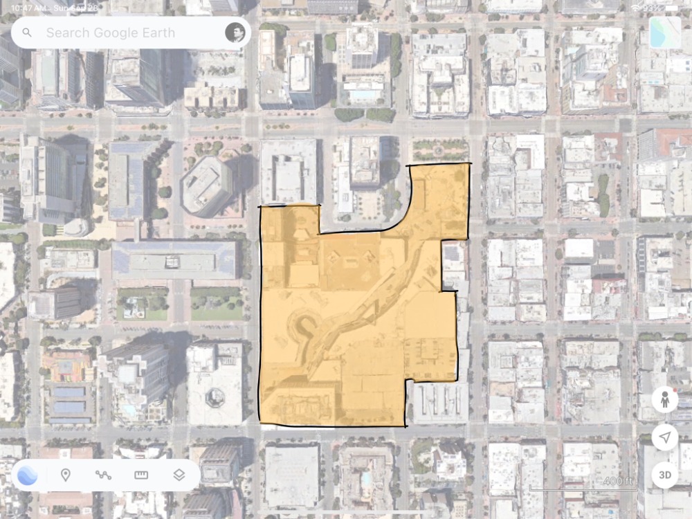
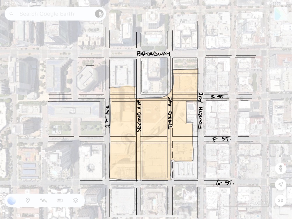
Last week, Vishaan Chakrabarti, founder of PAU, unveiled his firm’s housing analysis via The New York Times. The PAU founder says there is space for up to 520,245 homes in the city on roughly 1,700 acres of unused land. Most of it would be enacted above existing single-story commercial spaces.”

The article I read about the proposal, here, said they used, “available data on vacant lots, flood-prone areas, and the location of subway stations and other mass transit options.”

Uhm, well, okay… As stated in my previous two posts, that after 30+ years of illustrating the benefits of mixed-use, walkable, infill, transit-supported design, planning, architecture, and building, why are we still trying to sell the obvious? The NYT article references how infill is still controversial… based on Boomer NIMBY-ism. Or the lack of political courage to do what is right over the long-term.

Today it is an incredibly hard lift to get short-term politicians to address long-term issues against perceived short-term public interests, such as homeless on the streets (regional issue), interest rate fluctuations (national issue), and gas prices (international issues).

California’s housing crisis became a political crisis due to the technological advancement of social media to organize and coordinate a series of disparate Bay Area groups into one large YIMBY movement.  ‘Yes in My Backyard,’ led by Sonja Trauss, shifted San Francisco’s political approach to its acute housing and homelessness crisis to make these issues the city’s number one issues, beyond potholes and loss of parking spaces. The political structure of San Francisco, Oakland, San Jose, Sacramento, Los Angeles, Seattle, Portland, and San Diego followed in suit.

Social justice is today’s environmental movement of the 60s/70s, and economics in the 80s-00s. The third element of sustainability, we are learning how to build a more accessible and socially equitable city, which is why bicycles, walkability, shared mobility, complete streets, and transit-orientation are the focus of city making today. This housing crisis is a linchpin of the equity issue and I believe social equity/justice is a political crisis leaders must address. State laws are providing political cover for elected officials to pass new rules necessary to build more housing.

Lessons learned from SF’s YIMBYs to create a political crisis that makes change are:

– Organize various groups into one single-purpose, general issue group (with a catchy name)

    – Use new technology (social media expanded during their rise)

      – Put a charismatic leader with excellent public-speaking skills in front of the organization.

      – Provide political cover for our risk-adverse Mayor(s) to approve controversial housing projects.

      – Find and maintain the support of philanthropist.

      – Find and support like-minded candidates running for office on this project.

      – Sponsored policies dedicated to housing.

      – Educate citizens via various media to show how plans can turn into better projects. Provide reasonable tradeoff scenarios to educate everyday citizens. 

      To make this more citizen specific, this aligns with 5 Reasons People Accept Change (borrowed from reasons why people buy retail products):

      – Solves my pain – Homelessness is San Diego’s greatest pain.

      – This connects me to community – Everybody loves San Diego.

      – This makes my life easier – Able to conveniently access and enjoy beautiful spaces and places

      – This feels luxurious – San Diego is as beautiful as any place in the world, accessible to everyone.

      – This will make me more money – Our city can attract the World who’ll spend their money here.

      The following are ways to shift our cultural expectations necessary to change status quo, which takes time:

      Forces Within your Society: Homelessness is first. And then there are local advocacy groups or local connector/influencer people to collaborate with and an opportunity for coalition and capital building.

      Forces Between Societies: Regarding housing, State Law is the agent of change.

      Changes in our Natural Environment: Increased housing creates the need for high-quality amenity spaces. And climate change with longer, hotter, drier summers and wildfires are the low hanging fruit and take change out of our hands.

      Invention/Stimulus Diffusion: The new-new is faster smartphone technology, which is changing how we get around our cities with shared mobility and on-demand. Millennial culture ideas are making changes via smartphone technology inventions.

      Agents of Change. The best singular agents of change, are people who are culturally allowed to propose, advocate for, and succeed in making change are the following:

      Students/Faculty: Schools are teaching the future and past, but not status quo.

      Attorneys: Their job is manipulating the law and regulations.

      Designers/Artists: All projects are new and therefore represent change.

      Wealthy: Philanthropists are champions.

      Advocacy Groups: But they lack any authority.

      Long-Term Politicians: We have few in San Diego.

      Not Agents of Change. The least acceptable, singular agents of change, people not in the cultural expectations position to propose such and will eventually be your foil are:

      Chamber business interest/developers: Constituency groups that are risk adverse to change.

      Government Departments/Staff: They’re trying to equitable to all citizens, as change = winners/losers, and they’re not paid to make change.

      Churches / Religions: Maintain status quo.

      Community/Preservation Groups: Maintain status quo.

      Impoverished: Don’t experiment on the poor, they don’t have the resources to sustain failure.

      Short-Term Politicians: Our city council, Mayor, and County Supervisors.

      Politicians need that city-wide vision/principles/image to assist them in navigating the dichotomy of individual/small group fears versus larger city/common interests that this singular new project brings the city. And infill that builds mixed-use, walkable, transit-supported urbanism is our best sustainability tool.

      The State of Land Policy in America

      Uncategorized

      Recently, the Lincoln Institute asked readers to submit their best definitions of land policy. Being late, I offer the following that builds upon their submissions for your consideration:

      Land policy is the rules and regulations that govern the use, ownership, and management of urban and rural lands. It involves both rational and emotional decisions about how the federal, state, and local authorities determine land uses, who are allowed to access to it, and what activities are permitted on it. These policies trend with our collective social consciousness between individual property rights and common public good at both national and local levels.

      Land policy has both formal and informal outputs. Formal outputs are often plans, regulations, and programs. Informal outputs are often socially accepted patterns that shape our underlying cultural behaviors and social expectations. However, as stated in my previous blog, the federal, state, local land use policies are as misaligned as our current social and cultural malaise.

      The study of land policy was founded during the early 20th century’s Progressive Era in response to economically and environmental instability generated by industrialization’s overwhelming amount of poverty and pollution. The rising tide of the new industrial age/era wealth was expected to lift all ships, but apparently only the steel hulled ones stayed afloat. As JP Morgan, Carnegie, and Vanderbilt’s robber baron class drove our lassiez-faire economic policies towards violent race and class warfare during in the Reconstruction Era that led to the reactionary, government led Progressive Era.

      Land policies led to the establishment of local zoning controls in the 1930s/40’s. Then in the 50s/60s it was focused on urban renewal, and then environmental conservation in 60s/70s. In the 80s/90s it concentrated on redevelopment and economics. In our 21st century, it is focused on housing and social equity as our economy has again dramatically shifted, from industry to knowledge-based products.

      And so here we are again today, wrestling with lassiez-faire Republicans supported by capitalist oligarchs’ whose exploitative practices influence our highest levels of government policies and manipulate our media markets. They form monopolies to raise prices, pay subsistence wages, and exert control over natural and public resources to amass extraordinary wealth. And our current Democratic-led social justice and equity era is echoing the Progressive Era’s renegotiation of social norms in the face of violent white, Christian nationalism… Ugh.

      The GOP-led oligarchy system is being confused for authoritarianism. They’re not taking control; they’re abandoning the role of the government owning and managing the public good in trade for individual wealth creation. This is the state of Land Policy today…. the waiving of housing regulations while blocking the reformation of public housing to promote a supplyside, trickle-down response to chronic coastal city housing shortages. The focus on enabling regulatory-free development in transit areas policies without investing in transit supported infrastructure. And in economically static rust belt cities, nonprofits are expected to fill the void and role of both private development and public investments… Gah!

      We’re experiencing a new land policy era in real time. North American cities continue to transition towards more human-scale urban development patterns in our post-industrial society, and even more rapidly post-pandemic. And our land policy should be leading cities and neighborhoods towards economic, environmental, and social equilibrium and away from the predominantly individual interests over our collective needs… C’mon.

      “Are we there yet?” No… But we’re close.

      Economics

      I shared this very good 2013 documentary with a potential client in Fresno, California. And he asked after watching it if I thought Fresno was better off today from the ideas and potential presented a decade ago? I know Fresno is better off today than it was 10+ years ago because of its public and private investments highlighted in the movie. And it was a real change to restart the building of urbanism in a decades long suburban culture.

      Usually, this is when I self-righteously plow into the value of the New Urbanism and how 30 years ago we restarted and sustained this urban living revolution (with help from the sitcom, Friends). But it’s been 30 years, a full generation. And we should be fully building mixed-use, walkable, transit-supported urbanism at an industrial scale/speed by now, if measure by how long it took for the idea of suburbia to become reality. For example, Corbusier published the City of To-Morrow And Its Planning in 1929 and auto-oriented sprawl was in full bloom by 1959.

      Calthorpe, Duany, and Katz all published their groundbreaking books on the New Urbanism in the early 1990s and here we are in 2023. Why aren’t we there yet? We’re most certainly moving in that direction, but too slowly.

      That said, every city’s revitalization efforts suffered setbacks from the dramatic changes to how we work and commute due to the Covid shutdown. In California, we’re not building offices, retail is dead, and housing is king, because we’re building so little of it and we’re now working and shopping from home. I think that our Covid reset has to be overcome by all American cities, especially Fresno.

      The overall development and construction industry in California appears to be in a static point between the pendulum swings of change, from suburban to urban building. And no major city in California is building enough housing to meet its market demands beyond the few thousand or so built a year on the fringes in master planned communities by the few big home building firms leftover from the 80s.

      We have zero national or regional building/construction companies that build urban infill housing types at an industrial scale. We depend on 1,000 small-scale builders in every city to build enough housing to meet market demands, who are all learning and starting from scratch at the same time. Few are trained, prepared, or knows how to build urban infill housing at the scale of 2-3,000 homes annually.  Few city are able to build enough infill housing yet because:

      – The Federal Government neither insures/subsidizes its loans/mortgages nor invests in our transit facilities.
      – The State neither invests in transit services nor modifies building codes.
      – The City neither invests in job training/education nor reforms its entitlement codes (they waive them).

      All of these things were being done in the 1950/60’s as the Feds/State/Cities were in alignment to build suburban development at a massive scale. Feds changed its lending practices to subsidize single-family home mortgages. Fed and States built freeways and highways and their interchanges. States and cities built schools and colleges to educate ourselves. Cities created zoning to segregate work from home and enable master planned suburban development. America was a brave, new modern world post WW2. We were flush with cash and power and the world had changed dramatically by the mid-1940s.

      Today, we’ve shoveled all of our post WW2 wealth over to the Saudi’s for cheap oil to fuel our autopian suburban landscape. And were breaking ourselves financially to maintain the out-of-date and cheap suburban infrastructure, which is a losing financial scheme. This is all explained much better by Chuck Marohn and Joe Minicozzi.

      In short, we’re still not set up for building infill urbanism. And at this moment, California’s new urban infill development shift is being led by the State’s housing requirements and affordable housing incentives forcing city’s to waive their zoning (as opposed to reforming it). The Feds have started changing its policies too. But, these are just two of the six points the feds/state/cities need to be in alignment with in order to build infill housing at an industrial scale.

      It’ll take time to get all three aligned, and we’ll get there as we’re well past the suburban experiment… which proved to be the greatest misallocation of resources in the history of civilization (stolen from James Howard Kunstler). Ultimately, when you tug on downtown Fresno you’ll find that it’s connected to the world (stolen from John Muir).

      Town Planning, the Basics…

      Uncategorized

      Town Planning involves processes undertaken by municipal planning departments to visualize, plan for, coordinate, and act on the three-dimensional physical layout of the town. This includes the zoning of different areas for various uses, such as residential, commercial, and office spaces. It also includes the subdivision of public property and the creation of public streets and park spaces. In addition, it takes into consideration the economic, transportation, political, legal, environmental, utility and sanitation infrastructures.

      The goal of town planning is to achieve a desired urban form and to ensure that a certain level of accessibility, walkability, adaptability, efficiency, and economy are built in and adapted to over time. The public streets and spaces provide the long-term structure for building a town, and private development provides the day-to-day life within this framework is allowed to change and adapt as needed.

      Today, town planning discussion have been dominated by zoning, the regulation of private property. However, this focus on zoning can sometimes overlook the more permanent and important patterns of subdivision, which involve the ordering of public and private property. Therefore, the challenge in town planning is to balance these two domains of zoning and subdivision to create a town that is healthy, safe, and welfare-promoting.

      Basic Town Planning Elements Involves:
      • Development Patterns – Suburban to Urban Street/Block Types
      • Public and Private Spaces and Buildings – Location and Scale
      • Planning Types – from the Region to the Lot
      • Place Types – from Pristine Nature to the Town Center
      • Character – From Memory to Expectations

      (yeah, I used The Doug Allen Institute Chatbot to help me write this: https://app.docuchat.io/chat/48e19f7e-4aa5-4148-aed3-4be829e4c241)

      San Diego/Tijuana is a World Design Capital

      San Diego, Urban Design

      This is an excellent article about the need for design innovation in SoCal, and very apropos to San Diego. In short, the author explores ideas about the need to ween ourselves off of our car culture and recommends Building Expositions: Design thinking is applied to urban design through rapid urban prototyping, and as such through the primary tried and proven vehicle of international building exhibitions, which have had a successful track record for more than a century.

      San Diego/Tijuana has a history of important building innovations, starting with San Diego’s two early 20th century world expositions. First with the invention of Spanish Revival in 1915 by Bertrand Goodhue, and then with suburban sprawl in 1935 by the Federal Housing Authority. The suburban auto-oriented pattern of building was first exhibited in ’35’s FHA suburban model homes by Neurta and Eckbo, and it changed the world.

      In the 1950s, San Diego also invented Climate Change (Scripps GhG/carbon measurements by Roger Revelle and Charles Keeling), which dramatically changed our world too. We invented the modern LRT system, Transit-Oriented Development (Peter Calthorpe/Mike Stepner), modern ranchette house (Cliff May), modernist tilt-up construction (Irving Gill), Salk Institute (Lou Kahn), downtown urban malls (Jon Jerde/Frank Wolden), and we have UCSD’s Teddy Cruz’s study on cross-border construction techniques found nowhere else. Our latest UCSD/Tijuana Migrant Shelter (Teddy Cruz/Fonna Forman) and Cross-Border Terminal (Ricardo Legorreta/Blackson – yeah, I did the Site Plan) are important innovations too. Our bordering cities have a successful history of building innovation that needs to be celebrated.

      This is the value of next year’s WDC2024. The World Design Capital is a legacy thread that builds upon our history of innovation and has the potential to reshape our future.

      Buildings are spaces and places we inhabit as humans. Virtual Realities, Artificial Intelligence, and Autonomous Vehicles are appropriately named… they’re fake, false, impersonal, and limited. Salk/UCSD’s CAVE has faded after so much bluster in 2007, but is an early 3D/VR innovation, and something to be proud of. We need to build them to test our 21st century spaces and places, and share the risk/financing/rewards. For example, a heavy timber building was quietly built and successfully earthquake tested recently at UCSD. We need to test/build modular as well as Doug Austin’s concrete prefab patent idea. We need a place to share this knowledge and get onto our less suburban, auto-oriented future our climate and society demand.

      UCSD is leading our region in design thinking, and its Park/Market facility is our region’s design creativity Hub. It’s the center of our WDC2024. We’re fortunate to have both coincide today.

      When debating NIMBYs, I like to say that a community’s “character” is found in its memory (history) and expectation (vision). This idea of an International (USA/MEX) Building Expo center is a great idea and we have a history of success with it. Now we are able to ideate a new vision for our region during WDC2024 and beyond. It’s a character defining moment!

      And I wish to carry this idea through the WDC year as one of its on-going legacy goals. #LFGSD!

      Balancing the Math!

      Economics, Social Justice, Urban Design

      In general terms, the equation* to figuring out what the market rate housing rents are is to find the average local wage, times it employment opportunities, divided by the number of housing units available (*this is not a real math equation, it is assembling the elements that determine how the market place sets rents). While this equation is too simple, the basic point is that the rents rise in economically hot housing market cities because our growing upper-class wages are booming while the number of units available are limited. Higher wages times higher employment in cities that constrain new housing development equates to hot economic markets and higher rents.

      Wages have somewhat stagnating for the shrinking middle class since the Great Recession. And those who are able to are willing pay more and compete for access to the ‘good life’ in a city that has great amenities, such as arts, parks, rivers (Austin and Denver), nice weather, beaches, bays (Miami and San Diego), and those cities with a lot of jobs and amenities (Bay Area, Seattle, and Los Angeles). This amenity factor still fits with the simple equation above as those cities offering jobs and amenities are too few and far between. And those few safe, amenity and job rich places are unwilling to build enough housing to meet market demand. As people continue to look for places to spend their valuable time to inhabit, wealthy cities will have those neighborhoods that remain expensive for a variety of reasons, while a similar neighborhood in the same city, only a few miles away, will remain stagnant or declining economically and socially.

      Cities have a spectrum of economic value, from high to low, in context. Every city has a limited number of housing units available in high economically valued and amenity-filled neighborhoods to be rented by those few high wage workers who are in high demand and making significantly higher wages (+$200k/year). While the majority of a city’s middle class workers (+$60k/year) live in middle to lower economically stable and amenity-less neighborhoods. These new higher wages jobs drive up the rent in those few end-of-the-economic-spectrum high-demand neighborhoods and spill over into the edges of the middle class neighborhoods driving up rents and creating scarcity of middle-income housing (if more is not being built).

      The most socially just urban design solution is to enable and build more housing and jobs with amenities in more neighborhoods rather than allowing for higher wage earns compete for those few amenity-filled neighborhoods scattered throughout most cities currently experiencing job growth. Importantly, these wages, number of units, employment opportunities and the need for more housing production issues are only relevant for stagnant cities and towns across the United States Rust Belt and Midwest states. Which moves us into social equity and justice issues with displacement in these high growth cities and neighborhoods. Local people who are displaced from their long-standing homes is the unjust effect of gentrification as values increases. While increased investment in an area has positive outcomes, gentrification associated with displacement of long-term residents deny citizens the ability to benefit from new investments in housing, healthy food access, or transit infrastructure.

      To physically improve economically stagnant neighborhoods, with value generated from economic development and raise incomes, some manageable level of gentrification, minus displacement, is needed to improve and rebuild schools, parks, and market-rate development opportunities. Adding to this conversation is how work and shopping is physically changing in our neighborhoods, making 1960’s economic development models obsolete and new ways of building our neighborhoods and economies are making a huge difference in adding housing in older, pre-auto dominated neighborhoods. The auto-dominated suburban sprawl areas are in need of different tools to retrofit them. Conversely, in growing economic value markets, some manageable level of economic stagnation is necessary to enable more people to participate in the local jobs and amenities, such as subsidized housing, rent controls, and taxes.

      San Francisco is an expensive because it is affluent with a growing population and no land made easily available for development. Enabling and building more housing would stabilize or reduce rents as it adds supply to the inherent demand. New amenities, new design housing design models, and new neighborhood patterns are emerging. And with enough new housing to reduce prices and mollify its globally hot market rates for housing, the quality of the city’s urban design will make a difference in how San Francisco attracts new wage earners and retains its aging and long-standing citizens.

      Understanding this need to update its codes and design expectations, Seattle, Portland, and Denver have stabilized rents by building more housing. Using new zoning tools to allow for more housing in existing neighborhoods, these cities successfully changed their conventional zoning to a more form-based code type in anticipation of their 21st century development needs for mixed-use, walkable new urbanism. Form-Based Codes, or Objective Design Standards, prioritize where a building fits in its neighborhood context over the singular building’s primary land use. These cities reversed their once decimated social and physical fabric of their downtowns and historic neighborhoods by connecting and enabling isolated and segregated pods of development into well-connected and economically stable neighborhoods. And striking that balance between stagnant and hot economic markets.

      Your City Psychologist is ‘In.’

      Leon Krier, Urban Planning

      My favorite pop philosopher and psychologist is Alain de Botton, and his School of Life. They share a wide variety of articles and videos on relationships, architectural design, and beyond. I found his work through his 2006 book, The Architecture of Happiness. And what I appreciate about his approach to cities is that it has decidedly shifted from an original modernist perspective (2008), to the above book’s meandering thesis, and then to a clearly more traditional city making approach (2015). As I age in today’s era of great anxiety, I too find my perspectives changing. Some of these changes are attributed to conversations with an insightful therapist.

      One of the silly things I use to tell my municipal clients is that I was hired to be their city’s therapist. That I was there to listen, share case studies, analyze patterns, observe behaviors, and interpreting data to make recommendations on how best to build their city. This analogy would usually get chuckle and then I would go about my work that was policies, plans, and programs.

      But, like Mr. Botton, my thoughts have shifted with time. As a long-time conventional zoning code reformer, I see today’s municipal zoning trend finally moving towards meaningful reform. My own city of San Diego appears to be in its first steps of recovery from conventional, segregated land uses (commercial uses shall not have residential uses that shall not have industrial uses, and so on). Our Complete Communities and Inclusionary Housing programs waive most of our old zoning rules in exchange for affordable housing with very few zoning rules. This is done with the intent to lower or stablize the cost of housing (the rent).

      This waiver approach is a good first step in making amends for the errors of planning’s past. A dramatic shift, from too many rules to not many rules, allows us to move towards learning a new way to build more housing. But an unfortunate by-product of too few rules is rising land values and land speculation. This creates uncertainty as what is going to be built and how new housing will behave in an existing neighborhood context. Under these programs, a new building could propose 6, 14, 24, or 48 units depending on the owner’s intentions and distance from a transit or bus line. That’s a great first step in reforming rules, but without the next step of new parameters uncertainty, anxiety, and the typical fear of the unknown rises. The next steps would be to design new places that behave as intended in context.

      For example, a neighborhood center having more things going on on than the neighborhood edge along a canyon or freeway. An extreme example is building a downtown residential tower in an existing streetscape of single-family homes. This dramatic juxtaposition creates disharmony among neighbors (the fronts of people’s buildings adjacent to the backs of others), the marketplace (the first new tower drives up neighboring land values), and breaks expected neighbor boundaries while supplying new housing as intended for our region. This brings up ethical issues of common good versus being a respectful neighbor. The ethics of good community planning is to serve the public’s interest today by balancing social equity with economics and environmental elements to maintain livable and sustainable neighborhoods. I’ve written about such here, and the economics of it here.

      In personal and social relationships, the School of Life psychologist’s recommends we, “set boundaries that involves informing those around us of a set of objectively reasonable ‘rules’ that we need them to follow in order to feel respected and happy — while doing so in a way that conveys both warmth and strength.”

      Zoning regulations (codes) provides the rules that build the new places we live, work, play, shop, worship, and learn in. Zoning codes set the boundaries for the ways we live our lives.

      Citizens live in neighborhoods with the expectation to live a dignified, respectful, and happy life. Citizens tend to convey these experiences with both warmth and strength in regard/defense to the quality of their existing lifestyles, as well as expressing fear and anxiety in regard to unknown outcomes and experiences a new project/building/place proposal will produce. That’s the next step to zoning reform… a new type of land use regulation, Objective Design Standards, that presents explicit development standards for infill development in clear diagrams that show applicants, neighbors, and city staff what is allowed without relying on a decision of a hearing body.

      Zoning codes and city planning mediates this balance between today’s experiences and what changes tomorrow will bring to a neighborhood/place. And zoning is therapy because relationships need to be respected in order to maintain civility and happiness. While some want a pound of flesh for past sins, most of us simply want stability, structure, and connections with each other and their homes. As previously written here:

      We need to be grounded in that feeling of being around friends and family… Home. Being home is the idea that goes to the heart of what makes food (neighborhoods) great. It is an approach to cooking (zoning codes) that is rooted in respect. Respect for the ingredients (people/places), respect for tradition. It gives the fancy innovations and clever deconstructions a heart and a soul.“ – Anthony Bourdain, 2008 (Spain – No Reservations)

      Life is hard. Zoning sets the boundaries we need to live a respectful and stable life. Let’s continue to reform our city’s zoning through the lens of setting boundaries that involves informing those around us of a set of objectively reasonable ‘rules’ that we need them to follow in order to feel respected and happy.

      Objective Design Standards are Form-Based Codes

      Urban Design

      Posted on: https://www.cnu.org/publicsquare/2023/01/26/objective-design-standards-are-form-based-codes

      The state of California is responding to the nation’s second highest housing costs (behind only Hawaii) with regulatory reforms that promote form-based codes along transit lines and commercial corridors.

      California’s long standing “Not-In-My-Backyard” (NIMBY) culture has exacerbated the problems of high housing costs and homelessness. Over the past 50 years, conventional zoning ordinances and entitlement processes have conspired to support NIMBY intentions to stop new housing from being built near existing homes. But six years ago, state legislators began passing laws to address California’s acute housing crisis. 

      These bills are removing local policy and regulatory impediments to more housing via Objective Design Standards (ODS) with Streamlined Permit Processing. The intent of ODS is to build more affordable and attainable housing along transit and strip commercial corridors that are ripe for redevelopment. The Congress for the New Urbanism (CNU) has been championing these two important issues for over 30 years. 

      The influential Charter for the New Urbanism had its roots in California, where many of CNU founders helped write the Ahwahnee Principles in 1991 (the principles were, essentially, a first draft of the Charter). Unfortunately, the state, like much of the nation as a whole, continued to promote sprawling development patterns for three more decades. And yet, with 39 million residents, California is often at the forefront of regulatory and cultural trends. The Golden State’s land use reforms could have an important impact beyond its borders.

      Since 2017, CNU and California legislators agree that many of the barriers to building new urban housing are found in outdated zoning codes. Form-based codes (FBCs), developed by new urbanist practitioners in cooperation with cities and developers, are land use regulations that facilitate more predictable built outcomes, with explicit design standards that shape a community’s physical form. Both FBCs and the California’s mandated ODS are presented in clearly drawn diagrams and other visuals to show what is allowed without relying on the discretion of a city staff member and hearing bodies. 

      In 2003, Andres Duany and CNU-California Chapter members provided research that influenced Government Code section 65302.4, promoting the language and diagrams of form-based codes: “This tool achieves certainty over the physical outcome of land use and development decisions while enhancing flexibility to create more infill or infrastructure as needed. Cities in California that have used form-based codes, such as Ventura, Benicia, and Petaluma, provide examples of this practice.”

      Drawing by Howard Blackson

      The state’s ODS language first appeared in SB 35 in 2017, in the Housing Accountability Act. California cities are now required to streamline new development reviews using ODS. These regulatory standards are the now the only basis for cities to deny eligible by-right housing and mixed-use projects. 

      The following series of state laws require ODS:

      SB 2 Building Homes and Jobs Act (2017) provides technical assistance to help cities and counties prepare, adopt, and implement streamlined permit processes housing projects using Objective Design Standards (ODS). The California Department of Housing and Community Development, in coordination with the Governor’s Office of Planning and Research, developed this ODS toolkit to explain how these are more predictable and easier to interpret for all stakeholders, including decision makers, staff, applicants, and members of the public. 

      SB 35 Affordable Housing Streamlined Approval Process (2017) creates an opt-in program for developers that allows a streamlined ministerial approval process for developments in localities that have not yet made sufficient progress toward meeting their regional housing need allocation (RHNA). Eligible developments must include a specified level of affordability; be on an infill site; comply with existing residential and mixed-use general plan or zoning provisions; and comply with other requirements such as, locational and demolition restrictions. The streamlined, ministerial entitlement process relies on objective design standards.

      SB 330 Housing Crisis Act (2019) require a housing development project to comply with objective, quantifiable, written development standards, conditions, and policies appropriate to, and consistent with, meeting the jurisdiction’s RHNA share.

      SB 9 Housing Development (2021) requires ministerial approval of a housing development of no more than two units in a single-family zone (duplex), the subdivision of a parcel zoned for residential use into two parcels (lot split), or both. Authorizes a city or county to impose objective zoning, subdivision, and design review standards.

      AB 2668 Planning and Zoning (2022) further amend SB 35 by removing perceived ambiguities in the law regarding the application process and the local review process. And when a local government determines that a development submitted pursuant to this section is consistent with its objective planning standards, it must approve the development.

      SB 6 and AB 2011 (2022) rezones commercial areas on major boulevards for three-to-six story residential development that includes labor standards and health care requirements in a bid to improve conditions for construction workers and will go into effect July 1, 2023, until January 1, 2033. These require cities to enable a by-right, streamlined, ministerial approval process for multifamily housing with Affordable Housing developments located on commercial corridors using specified site criteria, objective design standards, and prevailing wage labor standards.

      In December, 2022, the Form-Based Codes Institute at Smart Growth America announced that Bay Area design firm, Opticos, won the 16th annual FBCI Form-Based Code Award for the firm’s Objective Design and Development Standards in Marin County, California. The award jury selected these ODS regulations as a model form-based code. Marin County’s ODS/FBC implements Marin County’s Countywide Plan through context-specific standards based on local development patterns.

      Cities are responding to ODS requirements in several ways. Many are simply ignoring the requirement and awaiting future state enforcement. Others are taking their current subjective standards, striking out subjective language, and hoping for the best. Still others are using dedicated state funds to hire experienced California new urbanists to reform local zoning via FBC models, such as Marin County, Santa BarbaraLos Altos, and Carlsbad.

      This ODS/FBC approach contrasts with conventional zoning’s focus on segregation of land uses, and the control of development intensity through abstract and suburban measurements (e.g., Floor Area Ratios, dwellings per acre, setbacks, and parking ratios), followed by a series of discretionary review permit processes, which historically has not provided enough housing and led to the state legislator’s intervention. In short, FBCs and ODS-explicit standards allow for faster permitting processes that are better regulatory tools to provide more housing on infill development-ready corridors. Let’s continue to reform California’s regulations to build more places that are transit-supported, walkable, sustainable, and enjoyable for everyone.

      Find additional Objective Design Standards and Form-Based Code information herehere, and here.

      IN SEARCH OF EQUILIBRIUM…

      Social Justice, Urban Design, Urban Planning

      Contemporary North American urban design tools provide a pathway for a more sustainable future by their ability to balance the competing economic, environmental, and social equity interests at the region, city, neighborhood, block, and lot scales. These Covid years appear to have accelerated development patterns that have been gradually shifting over the past three decades towards more sustainable outcomes. The United States cultural shift towards more urban living is well documented (Ed Glaeser, Triumph of the City, 2012). And contemporary urban development expectations are being built today as originally formulated by the Congress for the New Urbanism (CNU) practitioners in the early 1990s (Peter Katz, The New Urbanism, 1993).

      These three pillars of sustainability, environmental, economic, and equity, provide a structure for measuring or testing North America’s design trajectory today. The United States’ historical values, attitudes, and prejudices that built our 20th-century traditions, culture, cities, and buildings are being re-examined and deconstructed in today’s social equity and justice moment. We acknowledged the environmental pillar in the 60s and 70s. We learned to understand the economics of sustainability in the 90s and 00s. And this past decade we are immersed in a meaningful and healthy understanding of social equity.

      In the past, our culture (music, socializing, celebrations, food, worshipping) had secure foundations in public buildings, streets, squares, and plazas (churches, concert halls, theaters, pubs, and markets), and less so within the private home. Then the generation of the mid-20th century added the new by-products of the industrial revolution with television, cars, the highway, and suburbia to these public and private places (drive-in theaters, drive-thru diners, freeway overpass protests, tv movies, tv evangelists, tv news, home theaters, home cafes, home entertainment, backyard pools), which shifted our culture towards a more private life.

      Today, we are adding smart phone technology to these public and private spaces while shifting again, but this time away from insular private suburban culture and transitioning towards a more balanced public and private life. These smart phones are our 21st-century version of urban renewal, allowing us to re-inhabit and re-animate public buildings, streets, squares, and plazas cheaper, faster, and with more friends and family. Within a century, everything in our culture changed with how we share music, socialize, celebrate, eat, worship, and take selfies with smartphone technology in our daily lives and cultural norms. Importantly, due to the global pandemic, the design responses to shaping our cities, towns, and building are dramatically changing again.

      … in preparation of our ecological Pearl Harbor moment.

      Climate Action Plan, Social Justice, Urban Design, Urban Planning

      In designing our cities towards economic, environmental, and social equilibrium, we are able to achieve an ethical and sustainable approach to city building. The next few posts will be an exploration of the history, present, and future role of urban design in building regions, cities, towns, and neighborhoods towards a more sustainable city. As North America transitions towards more human-scale urban development patterns in its post-industrial society, and more rapidly in response to the urgency of the global pandemic, urban design is able to incrementally guide cities and neighborhoods towards more sustainable global outcomes. Our built environment’s acute response to the pandemic has prepared our society to respond immediately to forthcoming climatic calamities. The late 19th to mid-20th century of industrialized modernist era designed development, suburban sprawl most notably, are complicit in the scandalous emission of greenhouse gases that have rapidly changed our climate and resulting environmental and social malaise our world is experiencing today. The three pillars of sustainability, environmental, economic, and equity, provide a structure for measuring or testing North America’s design trajectory today.

      The United States historical values, attitudes, and prejudices that built our 20th century traditions, culture, cities, and buildings are being re-examined and deconstructed in today’s social equity and justice moment. We acknowledged the environmental pillar in the 60s and 70s. We learned to understand the economics of sustainability in the 90s and 00s. And this past decade we are immersed in a meaningful and healthy understanding of Social Equity. Depending on local context, the next urbanism will move our urban design processes towards achieving an equitable balance between these three pillars as the the most appropriate urban design response to social justice and economic issues is to build towards environmental, social, and economic stability or equilibrium.

      The Next New Urbanism

      Transit, Urban Design, Urban Planning

      This Covid year has accelerated development patterns that have been shifting over the past decade, and as originally formulated by New Urbanists 20 years before. Do you support transit-oriented development? Participating in charrettes? Reforming your zoning with form-based codes? Then thank a New Urbanist. There are many prominent patterns emerging right now, including less commuting; more home/work balance; less industry expansion; and more technology-based business growth in a post-industrial economy.

      Detroit Shifting Towards Industrialization Patterns in the 20th Century.

      These shifts are changing the way we work, just like the industrial revolution changed our world 130 years ago by creating new building types and city-making technology with the invention of steel. In response to that revolution, our cities were reconfigured with skyscrapers, blocks of offices/factories, highways, and cars.

      Many cities were reconfigured during that time, but Detroit is our nation’s most dramatic shift to and from industrialization patterns in the 20th century.

      Now, as we shift into our post-industrial age—and deeper into the age of climate calamity—we are able to measure both its successes and failures. For example, classicism works best at the human scale, but it failed us at the industrial scale when it became an ornament/style and a fascist/authoritarian tool. The international style failed us at the human scale but is ubiquitous because it’s faster, easier, and cheaper to build. And modernism was a disaster at every scale (Google Léon Krier; he was right).

      We are once again entering a brave new era with the opportunity to create a balanced approach to architecture, building types, and city-making techniques that are intended to civilize and modify the best and worst of our industrial advances with the best of our human-scaled buildings and places. By using a full spectrum of 21st century placemaking tools, the Next New Urbanism is able to advance the human condition toward a more sustainable future.

      .

      Pre-Industrial and Post-Industrial Urbanism… in search of Equilibrium.

      Industrialization (or The Education of Howard Blackson)

      Climate Action Plan, Leon Krier, Urban Design, Urban Planning

      Industrialization via the internal combustion machine changed the world (or the Dynamo as described in the great autobiography, The Education of Henry Adams) when it created steel that created new industrial scaled building types. The factories, offices, and skyscrapers were invented in the late 19th century. And because this invention happened during our western civilization’s Neoclassical era, this familiar classical architecture was applied and used to ‘humanize’ these new buildings. However, because the building forms were new, the classicism was applied as a façade, and thereby is ornament… or this mismatched scale made classicism more of a style than a building technology.

      A New Age Industrial Scale Office Building Expressed in a Classical Architectural Style, 1920
      A New Age Skyscraper in the Classical Architectural Style.

      The technology of building at the human scale was obliterated by the modern industrial materials, energy, and resulting scale. Along with these new engines and buildings, new forms of mobility rose as well, trains, streetcars, and then automobiles transformed with the age. The industrial scale of car production created another mismatch in our traditional city environment. Industrialized suburban sprawl was fueled by this auto production.

      Leon Krier Alerted us to this in the Early 1970s.

      Modern architecture formed in a parallel track. Le Corbusier’s 1923 book, ‘Towards a New Architecture‘ responded to this new scale w/an industrial design aesthetic post WW1. And until post WW2, cities used both classical and international styles on modern scaled buildings and places. And I am writing this next sentence as carefully as possible because it is an extremely volatile subject… it was the WW2 fascist Axis power’s adoption of classicism as an authoritarian tool at an industrial scale that shamed the use of classicism almost out of existence for generations in both academia and society’s elite. For such, classicism was rightfully deemed a failure. Leaving us limited to only one architectural tool, the untested International Style/modernism, to integrate industrialization into our cities over time. And it eventually failed too.

      Industrial Scaled Buildings Expressed with International Style Architecture.

      Classical style failed us architecturally at the industrial scale. It had worked fine for thousands of years pre-industrial age and scale. And the International Style failed us urbanistically when applied to the pre-Industrial city. And I dare say the Industrial scaled city (suburban sprawl) has failed use urbanistically as well. This was a lesson Frank Gehry’s ‘Bilbao Effect’ taught us. That the traditional city works great and modernist architecture fits in it well in juxtaposition to it and its classical architecture… adding complexity and excitement to the same old classical buildings set in the same old traditional streetscapes.

      Bilbao’s Big Idea Wasn’t, “Hire a Starchitect!” It Was the Architectural Tuning of Place to Create Complexity!

      The following are general lessons learned. Modern architecture works fine above the traditional city as long as it doesn’t meet the street/ground. And, classical/traditional architecture works well at the human scale when it touches the ground, but it has to be at the small block and up to mid-rise scale (not at an industrialized size). The traditional city pattern works best to make urbanism. Modern architecture works well when set in natural spaces.

      The Salk

      Using all of these tools today allows us to build better cities, places, and experiences. A century and change later, we no longer need to censor one while villainizing the other. They both work fine in certain situations and not so well in others. These are just tools that can work together if we understand how to use them.

      Expanding on Leon Krier’s Tuning of Architectural Settlements with Classical and Non-Classical Buildings Creating a Variety of Place Types.

      We are unfortunately in a new climatic calamity era and are thereby fortunately free of the surly bonds of mid-20th century style wars. I find it maddening that designers and urbanist still argue over style when industrialization is the root cause of our current climate/social calamity! We industrialized work and segregated our society. We industrialized our food and have put our health at risk. We used industrialized machines to emit coal and oil carbon particles into our atmosphere and are heating up our finite planet. We industrialized our health care and extended our lives and increased our population, so it has its merits too. What we need to address is that most people still see industrialization as the only tool to fix what originally caused these calamities… truly, a modern day Aesop’s fable.

      In our new 21st century post-industrial/climate calamity era, we are now able to use every tool available to us to build more sustainable cities and places that range from More Industrial to Less Industrial / More Traditional to Less Traditional depending on its context.

      Finally Free to Design Using all of our Tools in the Toolkit!

      The City Making Process Takes Visioning, Coding, and Implementation.

      Urban Planning

      I was intrigued by an intelligent comment on Twitter, by @EricsElectrons, who put this nugget of truth out there and I got all excited about its process of intellectual elimination:

      Everyone discusses problems.

      Very few can come up with practical solutions.

      Even fewer can objectively weigh all costs and benefits of all proposed solutions and then put into practice the best tradeoffs to correct for current problems.

      Then I realized that he’s doing a great job describing the decision-making process cities go through when making city making decisions. This process of elimination is a form of subsidiarity enabling those few elected decision-makers to determine how we fix problems. the steps are:

      First, a problem is identified, because everyone discusses problems. Let’s say for this post the problem is not enough middle-income housing in San Diego. How to solve for building more middle income housing in an economically hot coastal city is difficult and there are few practical solutions as most are complicated and convoluted that take time to realize. We understand the problem and we state a vision, “We need more middle-income and affordable housing in San Diego!” We’ve done this for many years with our city council declaring a ‘housing crisis’ annually.

      And, because these complicated policy and long-range time fixes in need of multiple groups to enable, very few can come up with practical solutions. So, we need a plan that starts with the vision stated above, as well as practical solutions listed by planning scenarios that illustrate the costs and benefits (CEQA is a state law that is supposed to simply disclose the costs of new development) with objective-based data, such as this much VMT, GhG, number of housing units, retail, and so on. These plans codify the road map to get from problem to solution. The value of plans is to avoid duplication and waste of public investments, unite citizens to work towards a common vision/future, and show us practical, sensible ways of providing a place for everything we need to live in a more sustainable city.

      Third, our elected and appointed leaders, we only have a few (zoning administrator, planning commission, city council, mayor, city attorney – why – and, county supervisors and commissioners opine on city making decisions) who are allowed/enabled to objectively weigh all costs and benefits of the planned solutions and then approve/put into practice the best tradeoffs to fix our stated problems. For middle income housing, the city of San Diego is choosing to use tools in our our Affordable Housing program and Complete Communities program in an attempt to solve our oft-stated problem. So, Eric is right… and rational.

      The steps to solve for identified problems that affects everyone stats with understanding the problem, making a vision statement for our intended outcome, and then making codes and plans for ways to fix the problem. This direction is then decided by a select few who weight the costs/benefits using objective data.